Dear friends,
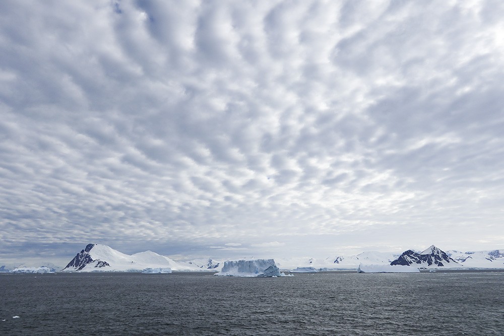
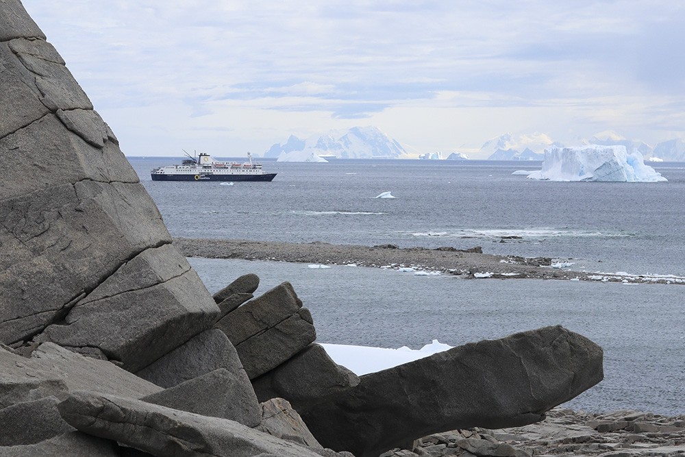
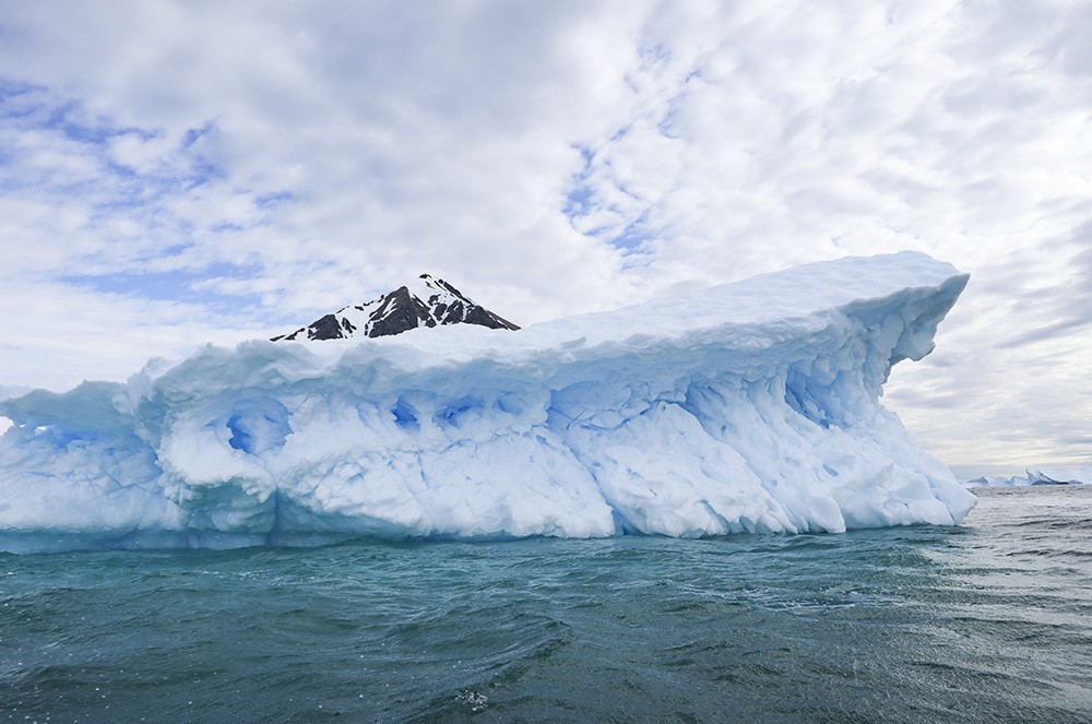
After our transverse of the Lemaire Channel and our zodiac zipping through the Iceberg Garden, we traveled further south overnight and all through the following morning. We passed more and more huge icebergs and even witnessed a few calving.
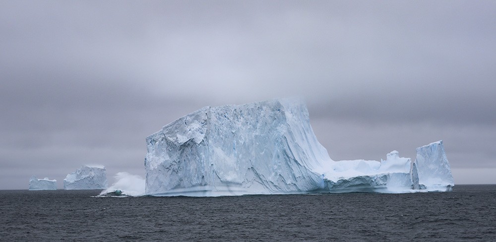
A chunk of this iceberg cracking of the left end, and creating a dramatic sight, a mist of ice and a surging wave.
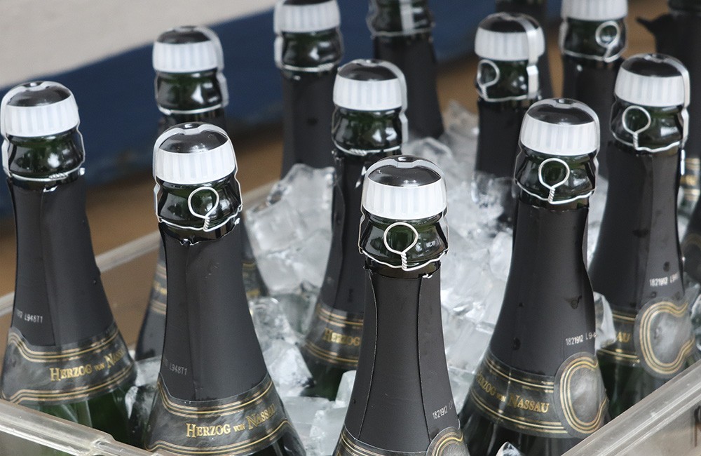
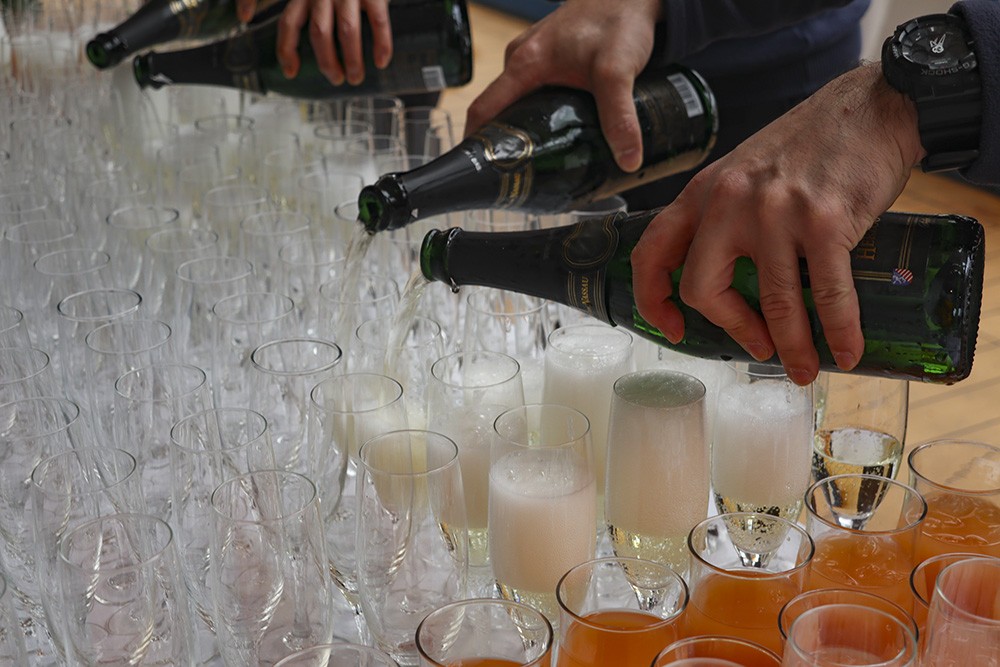
Seeing crates full of ice and bubbly out on the back deck while we iceberg watched, boded well for a crossing of the Antarctic Circle that afternoon. The Antarctic Circle is a parallel of latitude at 66 degrees 33.6′ South and lies 2,606 km from the South Pole. The area encloses about 8% of the earth’s surface and encompasses almost all of continental Antarctica. It marks the northern limit of the area in which the sun does not rise on the summer solstice (21 June), or set on the winter solstice (21 December). Periods of continuous night or day increase from one day at the Antarctic Circle to 6 long months at the South Pole.
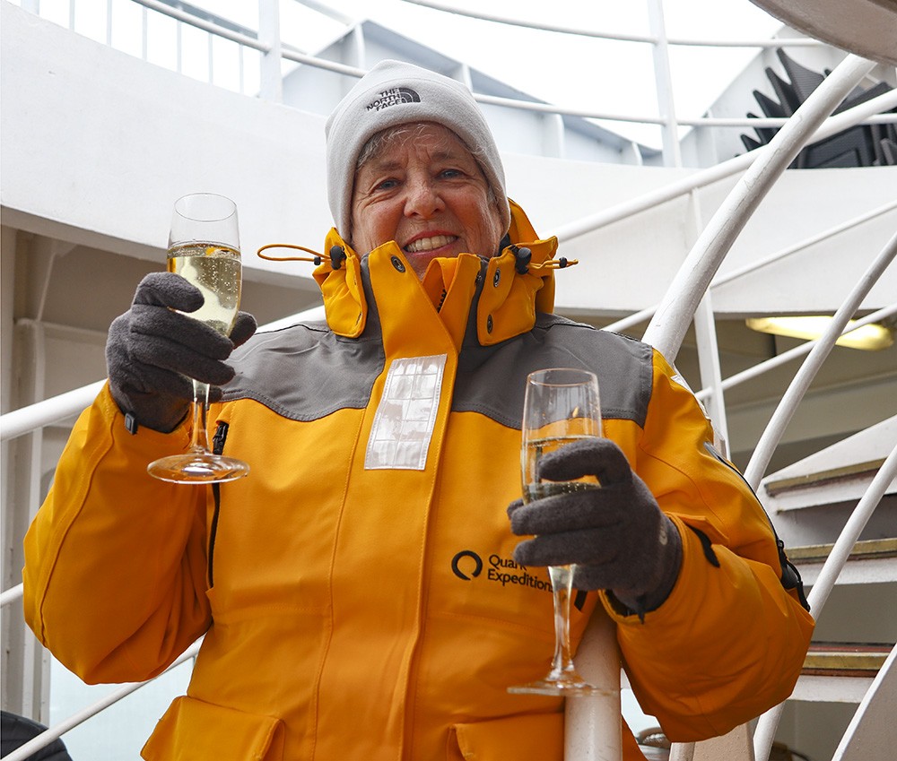
Ready to celebrate the crossing.
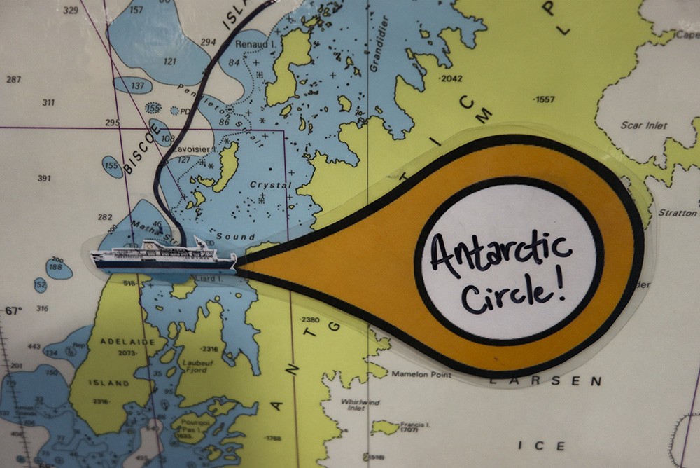
So on 22 Jnuary 2020, at around 3.30 pm, the news was posted on the maps dotted around the ship,
and all the passengers were invited out on deck …
… to witness the crossing and celebrate accordingly.
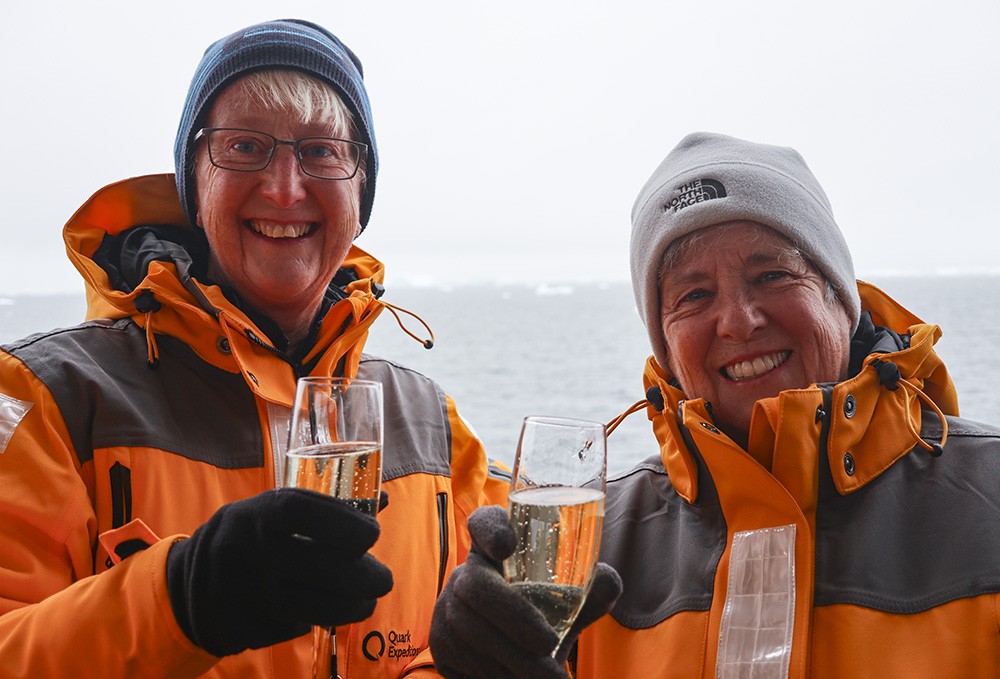
Happiness is celebrating our southern adventure, visiting the 7th Continent and crossing the Antarctic Circle.
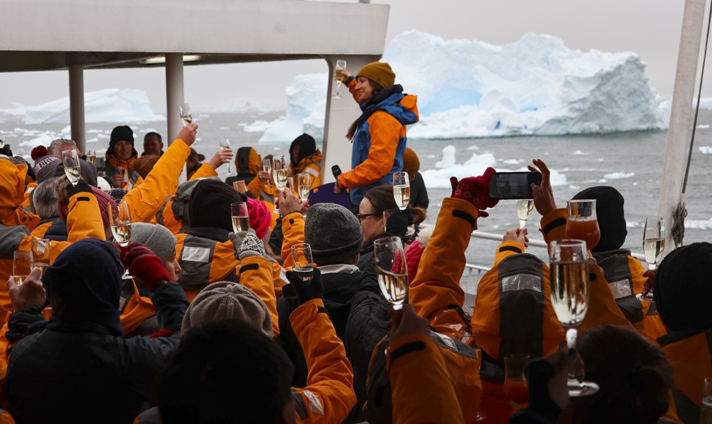
Our Expedition Team Leader Laurie said a few words and read a touching poem and then asked us all
to raise our glasses in celebration, the photo capturing a giant iceberg drifting by.
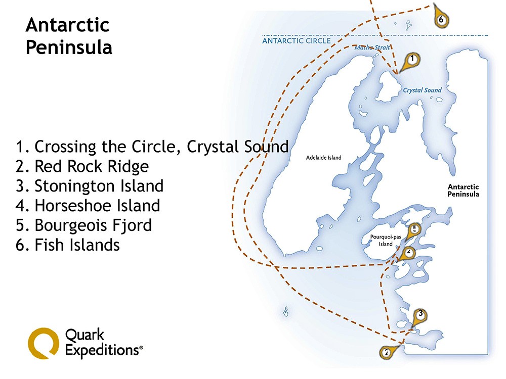
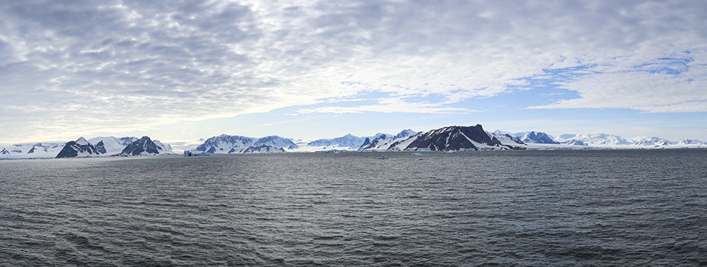
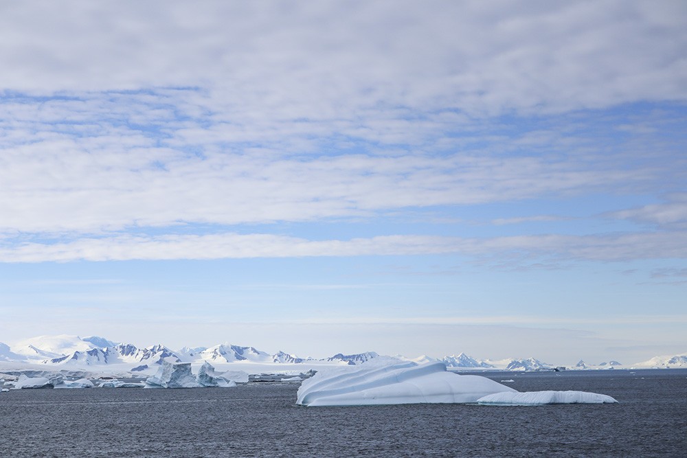
After another long overnight travel pushing still further south and the following day, we made two landings, firstly at Red Rock Ridge and then on Stonington Island at around 68 degrees south. All the Expedition Team were very excited to tell us that this was the farthest south most of them had traveled, and it was even a first for the Captain.
A gorgeous sky as we sail towards Red Rock Ridge.
That’s Red Rock Ridge to the right, rising to 690 metres, with a line of snow-clad mountains beyond.
Looking beyond and to the east of Red Rock Ridge as we set out on our zodiac cruise.
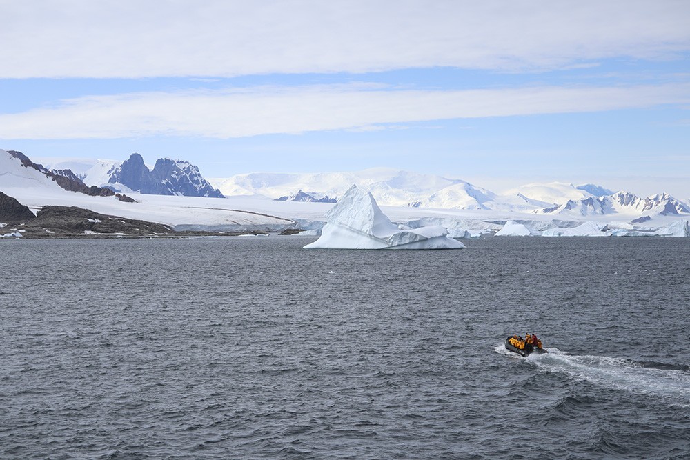
Plenty to explore with an hour in the zodiacs before our group lands at Red Rock Ridge.
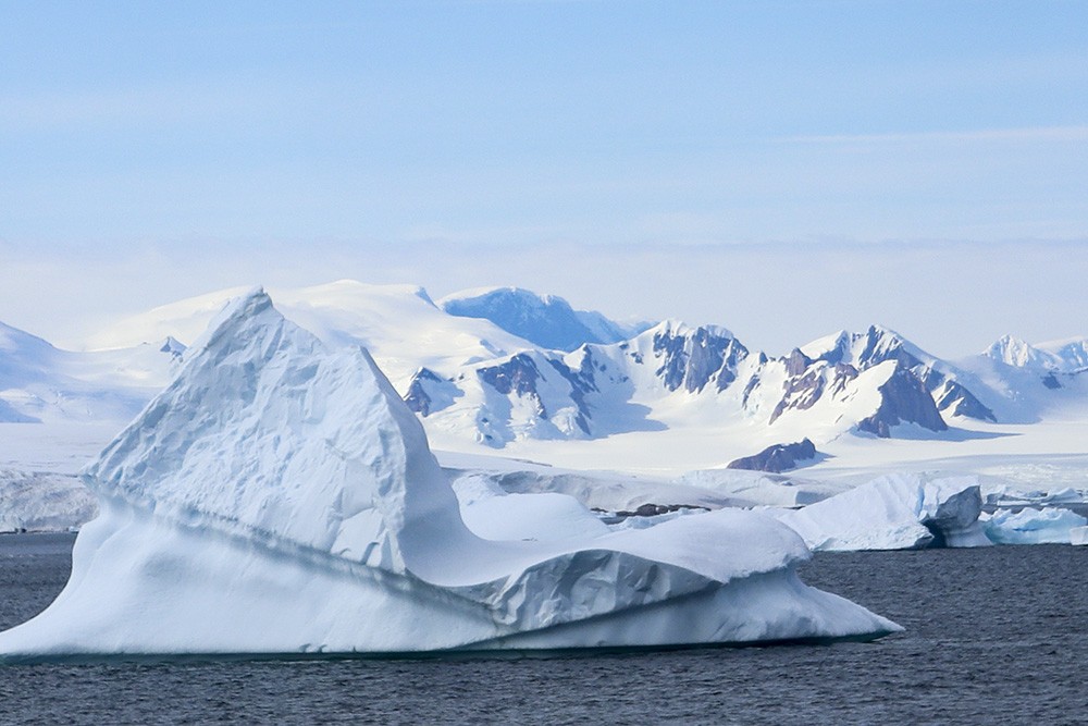
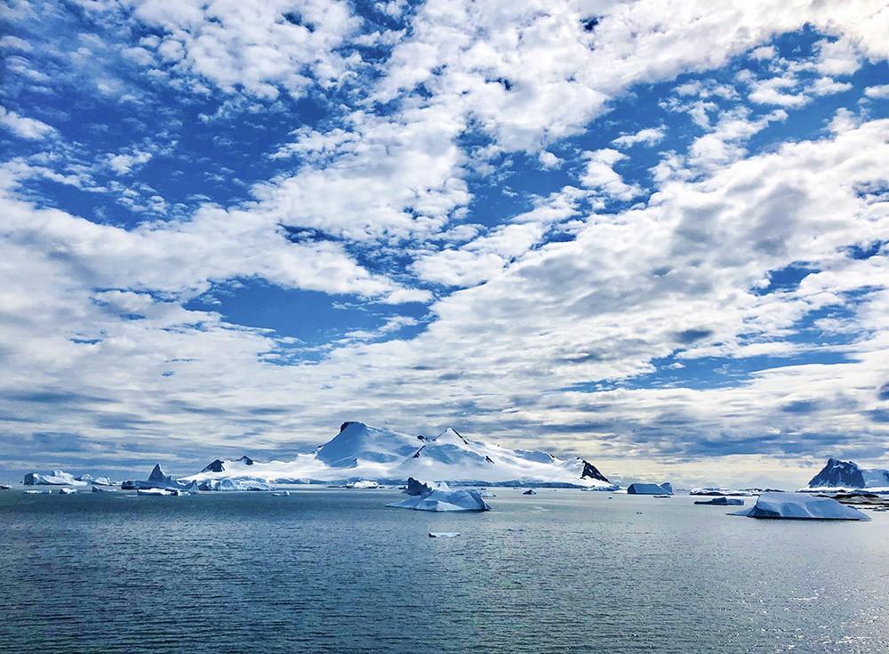
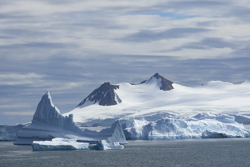
Stunning icebergs and mountains fill our vision.
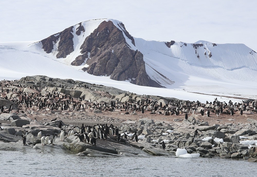
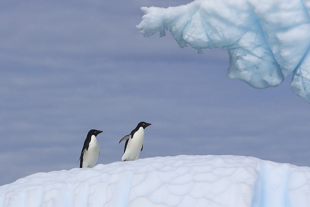
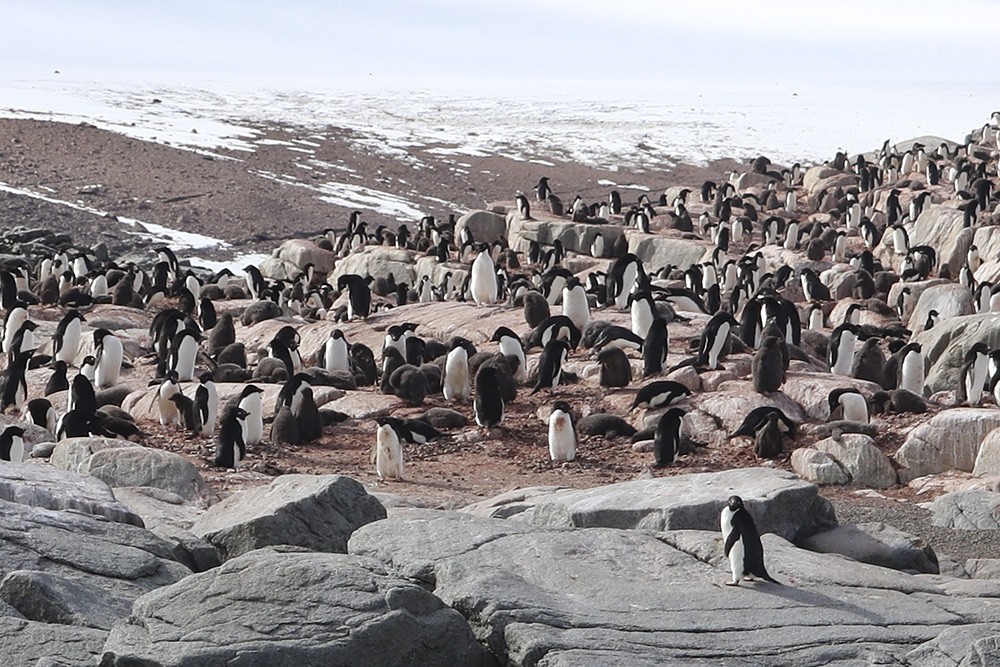
A colony of Adelie penguins on the red earth which gives the name to this area of the Antarctic Peninsula.
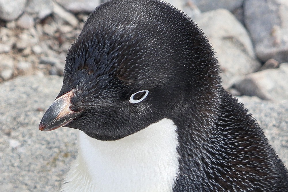
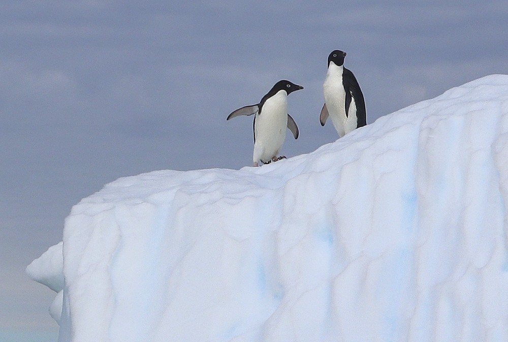
Adélie penguins are mid-sized (46 – 71 cm in height and 3.6 – 6.0 kg in weight) They have a distinctive white ring surrounding the eye and the feathers at the base of the bill hide most of the red bill. The tail is a little longer than other penguins’ tails and the appearance looks somewhat like a tuxedo.
Adélie penguins are common along the entire coast of the Antarctic continent, which is its only habitat. It is the most widely spread penguin species, as well as the most southerly distributed of all penguins. It is named after Adelie Land, which was named for Adele Dumont d’Urville, the wife of French explorer Jules Dumont d’Urville, who first discovered this penguin in 1840. Adélie penguins obtain their food by both hunting and foraging, with a diet of mainly krill and fish. They can swim at around 8 km per hour and they are able to leap some 3 metres out of the water to land on rocks or ice.
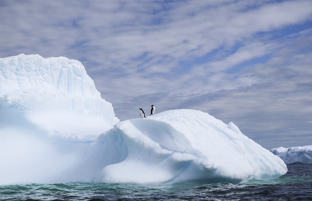
Picture perfect – two adélies on a sculpted iceberg between the aqua of the sea and the blue of the sky.
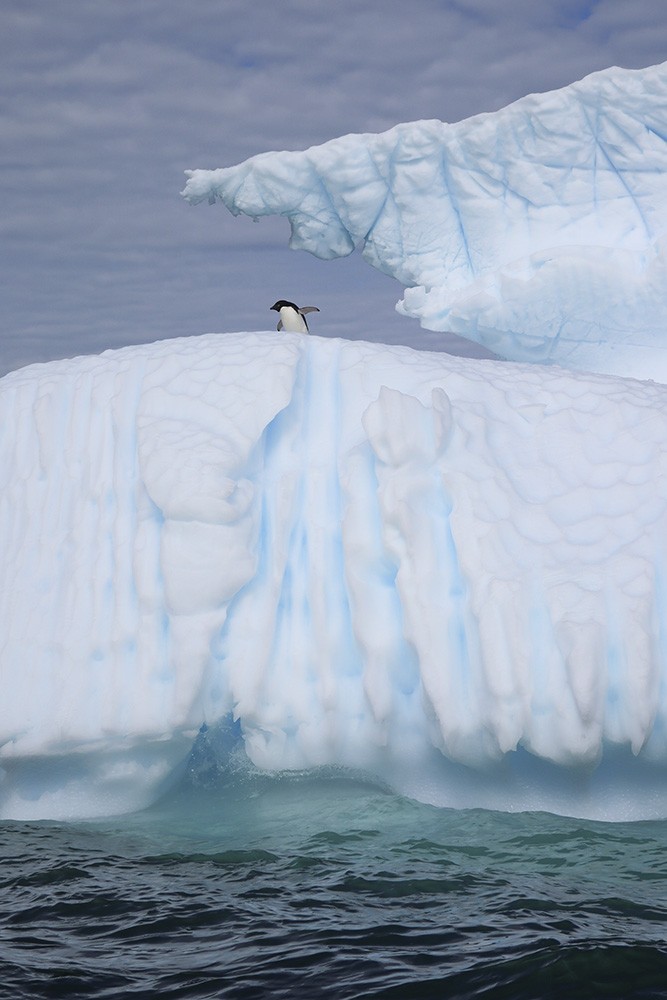
These pix really show off the glorious adventures we experienced every day.
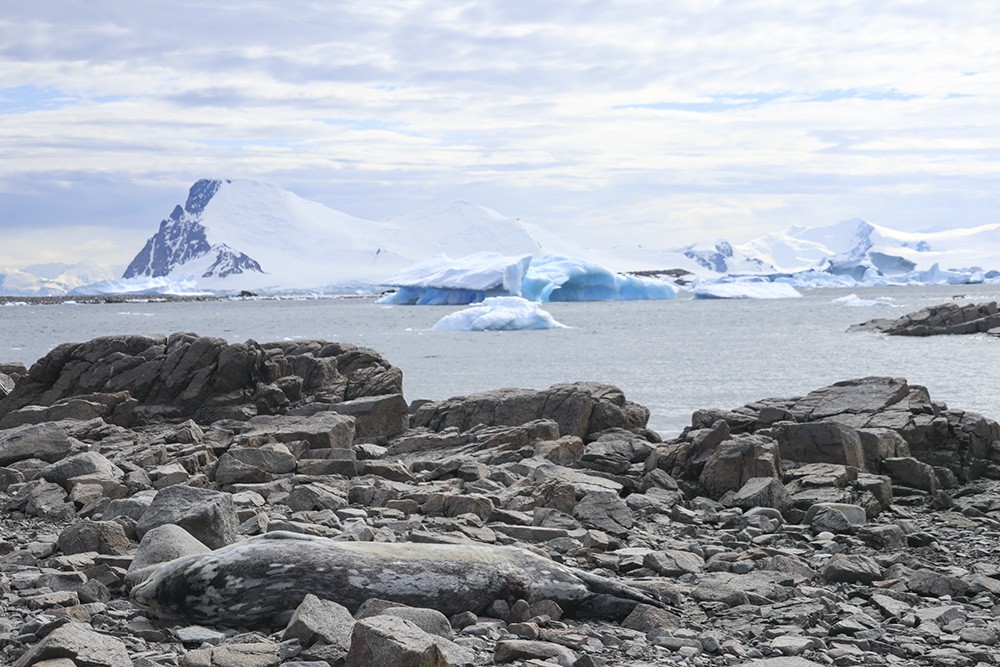
Walking around the base of Red Rock Ridge there were plenty of seals, not always easy to sport like this one.
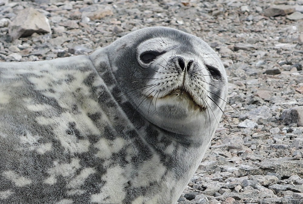
Others were more curious, would raise their head to survey the intruders and then lay supine again.
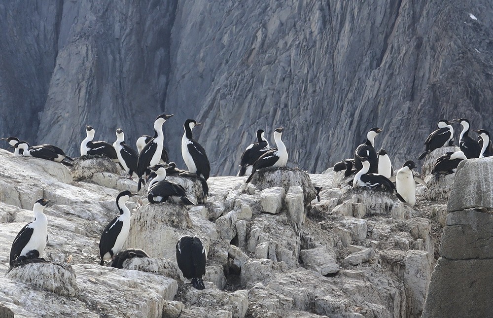
Higher up on the cliffs there were many nesting Antarctic Shags.
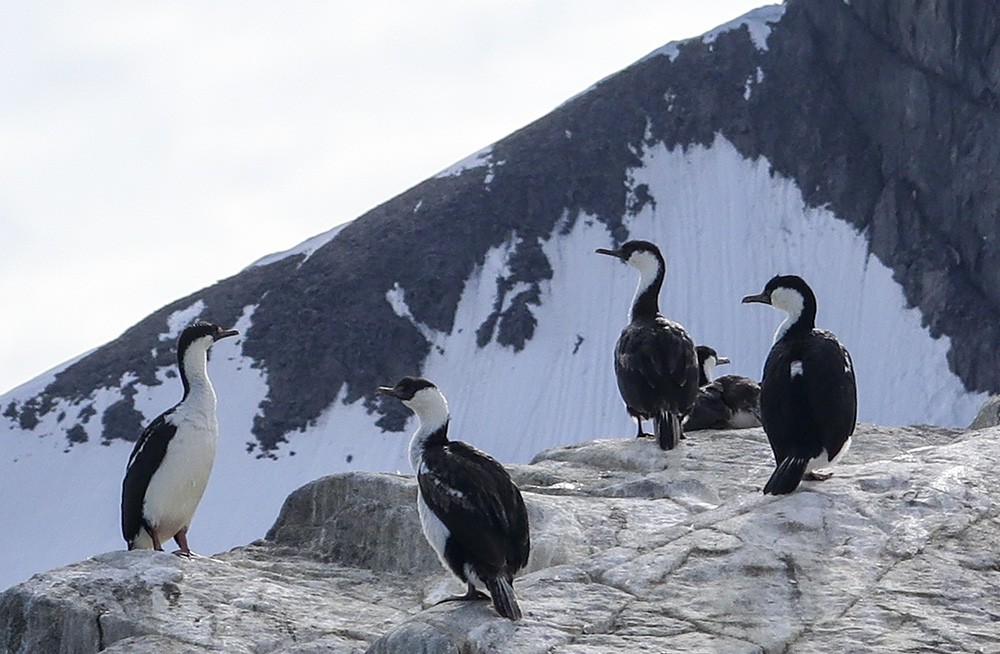
The Antarctic shag is one of the families of cormorants found in the islands of the Antarctic.
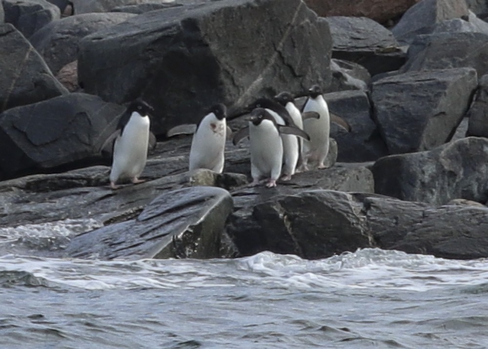
A group of Adélies ready to brave the water.
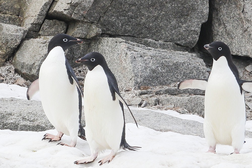
And another little trio wanders by, completely unperturbed by the human visitors.
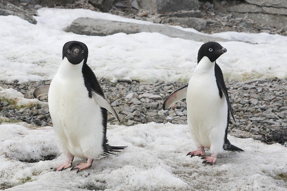
First there were three, and then there were two, one rather more plump than the other.
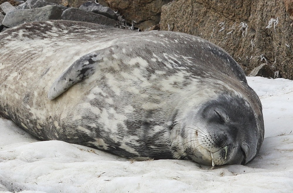
Another seal lies drooling on the snow.
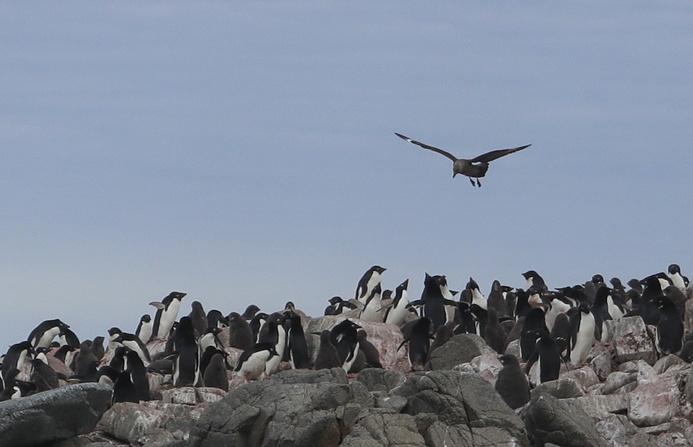
But not all is peaceful as the skuas are constantly circling and diving, looking for their next meal of penguin chick.
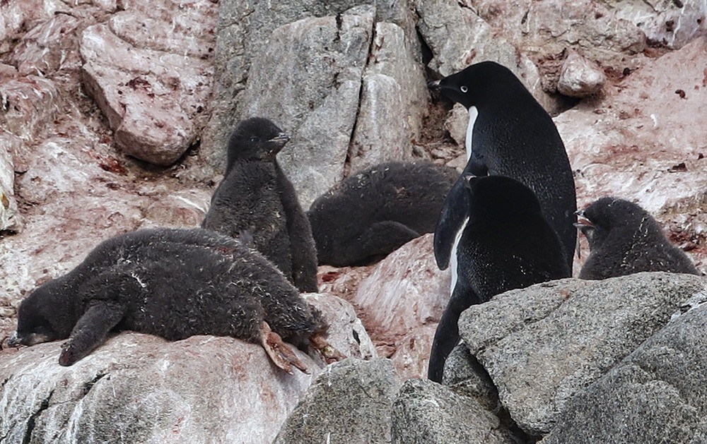
However, in January the penguin chicks as growing fast and nearly as big as their parents -really just large grey fluffballs.
Some wonderful viewpoints and interesting rock formations at Red Rock Ridge.
In the afternoon, we traveled a short distance to be ready for the landing at Stonington Island which lies in the east of Marguerite Bay, off the west coast of Graham Land. This island 600m long and 300m wide was once connected by a drifted snow slope to the northeast glacier on the mainland.
Bright skies make for stunning photos – this one with my iphone – please note, no added colour!
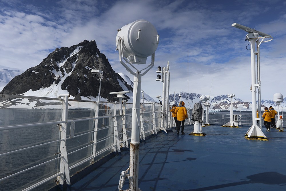
Wonderful to be up on the top deck as we make our approach with magnificent views all around.
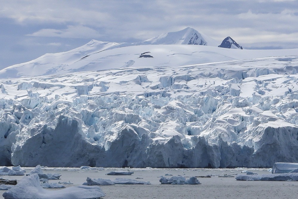
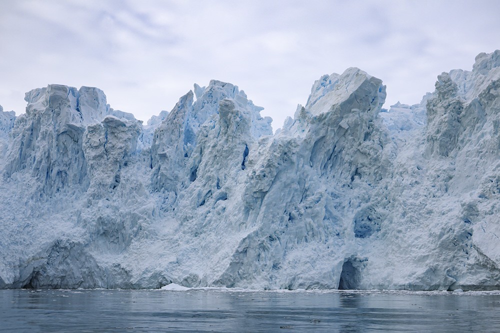
The face of the northeast glacier as it tumbles into the sea.
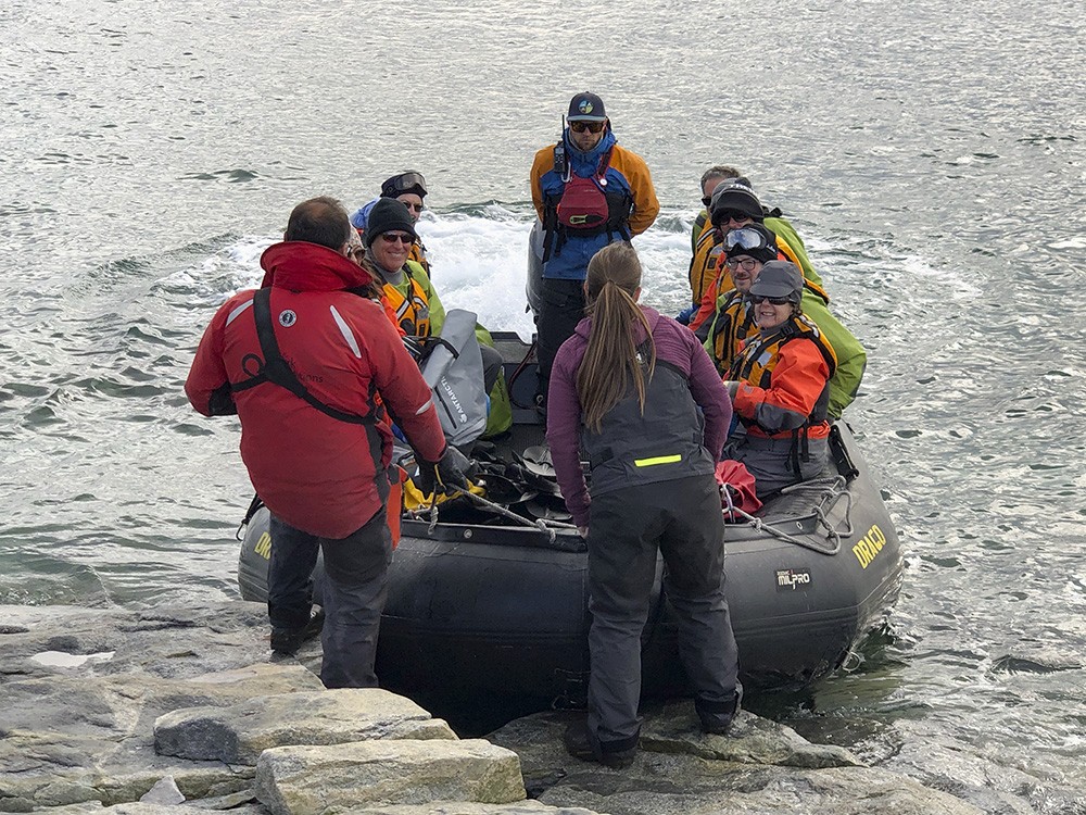
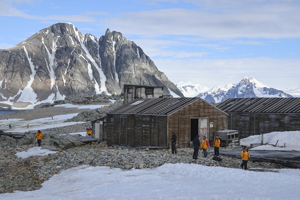
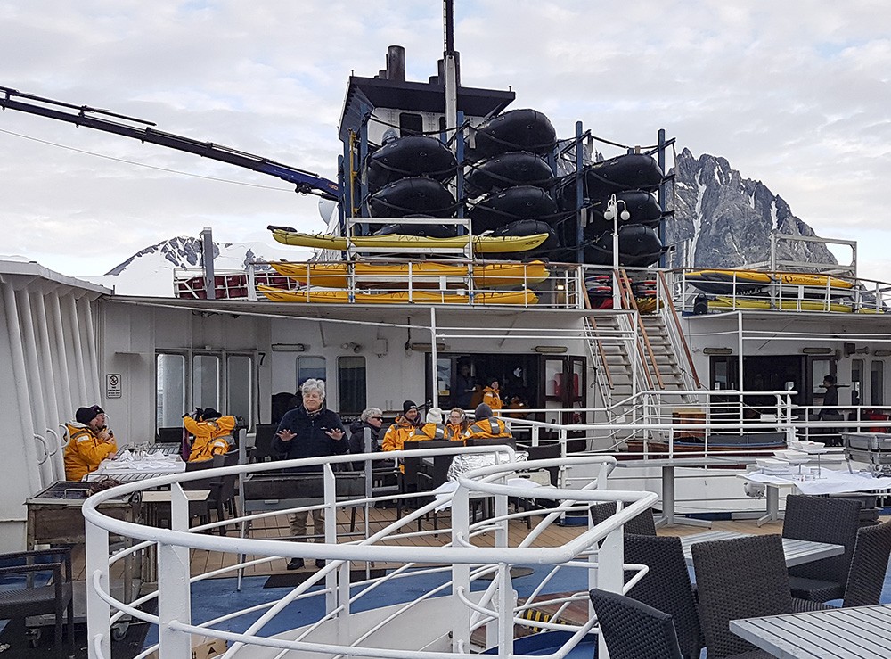
A group making their landing on the island, with two of the Expedition team giving a briefing on what to look out for,
where not to go and how long for the stay on the island.
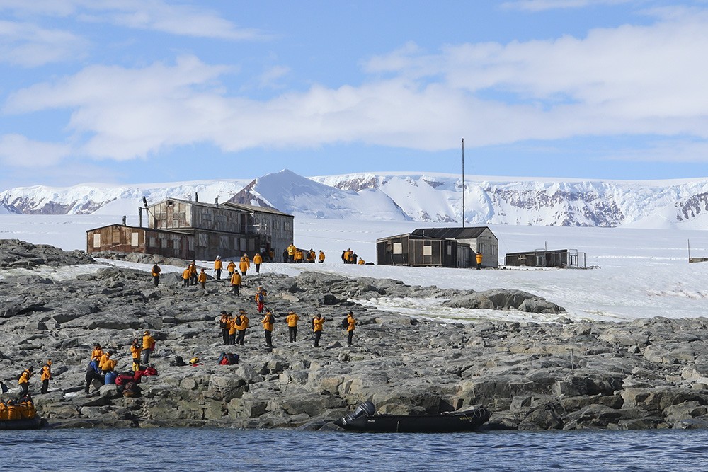
A great island and huts to explore, and enough time to find a quiet place to sit and contemplate the views and history also.
The island was the home to the British Antarctic Survey (BAS) Station E, and the Ronne Antarctic Research Expedition, and was the base of operations for many historic Antarctic Peninsula surveying missions in the 1940s. Station E was occupied until February 1975 and the main building, known as Trepassey House was cleaned up and repaired in 1992. The huts are protected under the Antarctic Treaty.
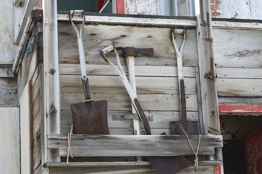
Well-used shovels and picks at the entrance to the hut.
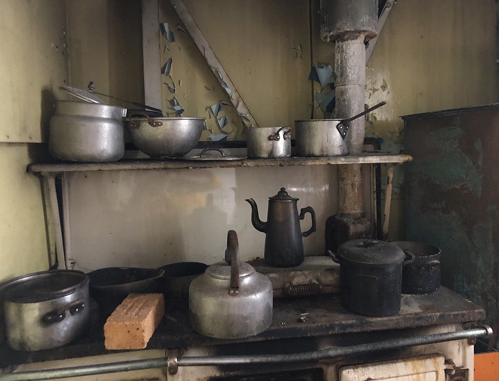
Blackened pots and pans and a coffee pot stand on the hob. And the brick? Maybe to warm a bunk on a freezing night?
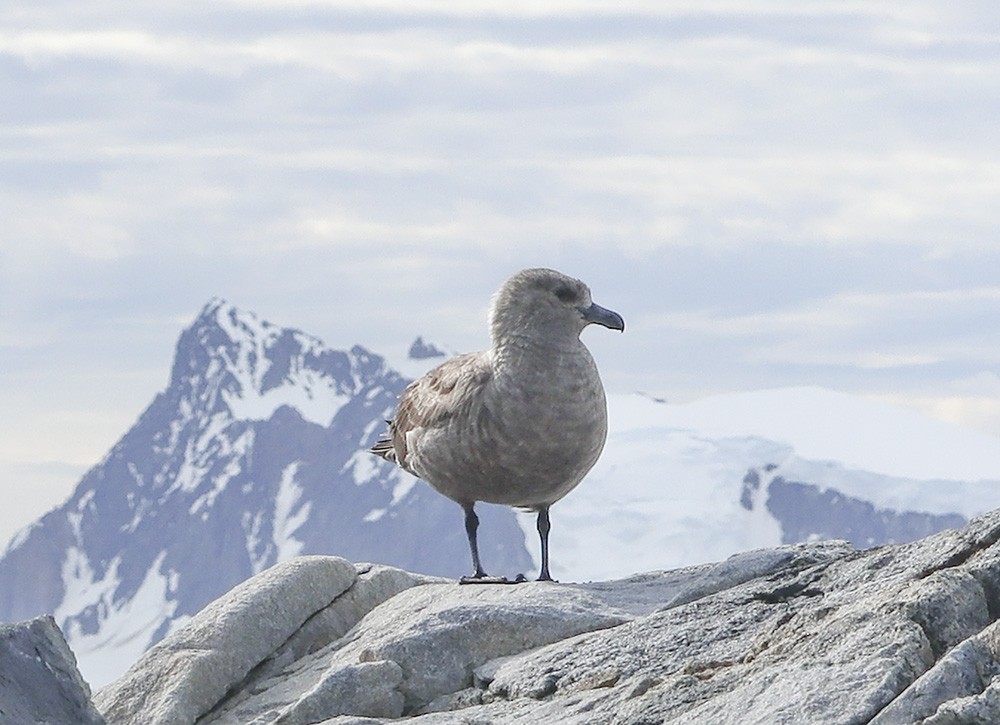
A south polar skua perches on a rock to survey the scene.
The huts of the East Base of the US Antarctic Service. Unlike many of the British huts, they are not being conserved or restored.
The Island was also chosen as the East Base of the United States Antarctic Service (USAS) Expedition from 1939 to 1941. The island is named after Stonington, Connecticut as that was the homeport of the sloop ‘Hero’ in which Captain Nathaniel Palmer sighted the Antarctic continent in 1820. This also designated as a Historic Site.
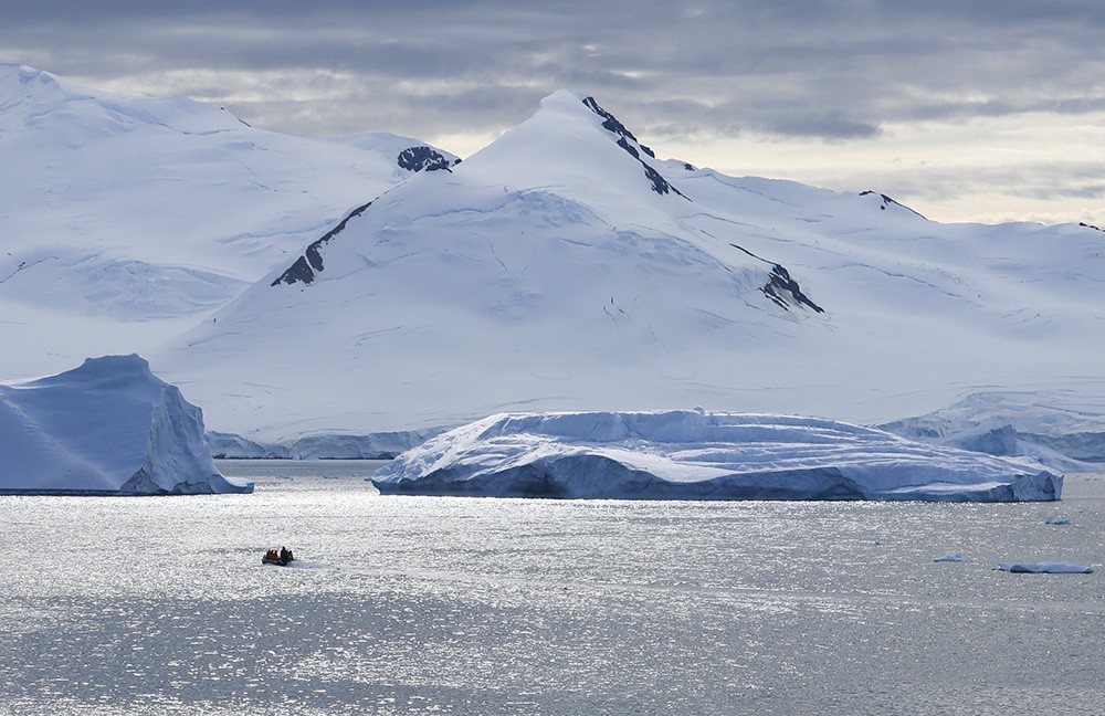
After the visit to the island, we spent an hour in the zodiacs circling icebergs and running right under the face of the glacier.
Look at those colours in the iceberg, and below.
The peak of the iceberg echoing the peaks of the mountain behind.
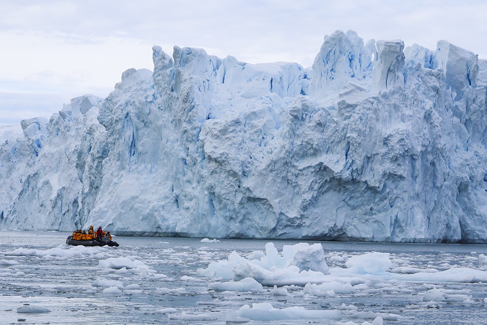
The rugged and crevassed face of the glacier towering about the zodiac.
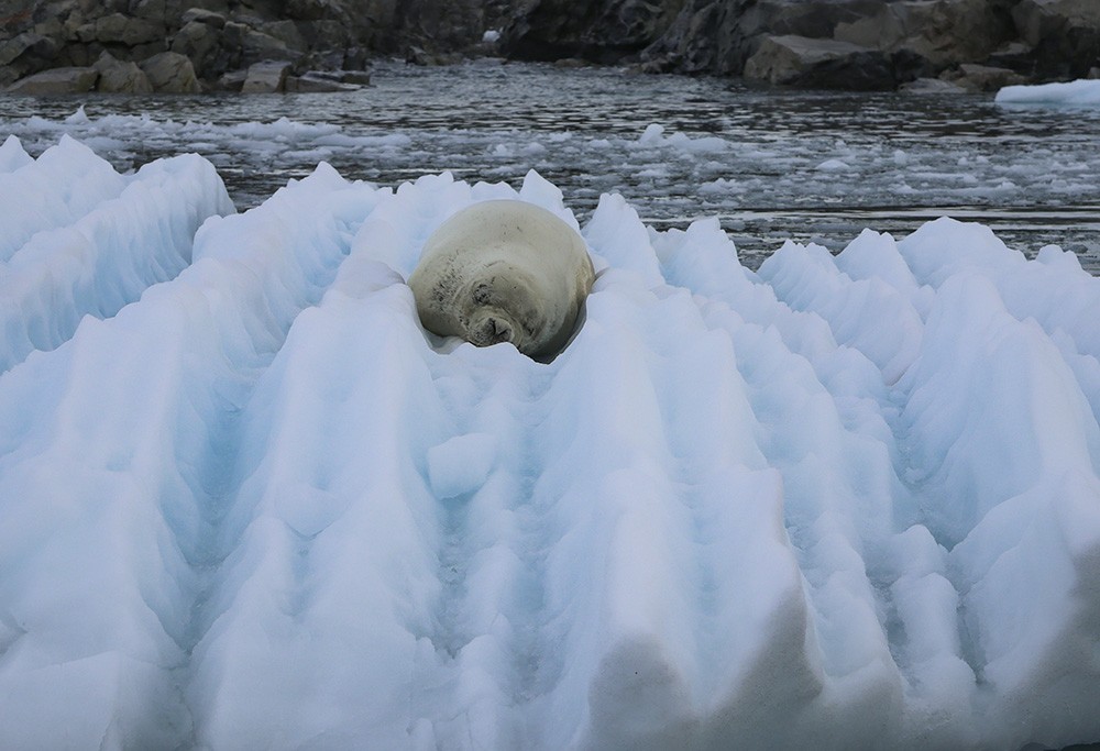
A corrugated iceberg, calved from the glacier, makes a comfortable bed for this seal.
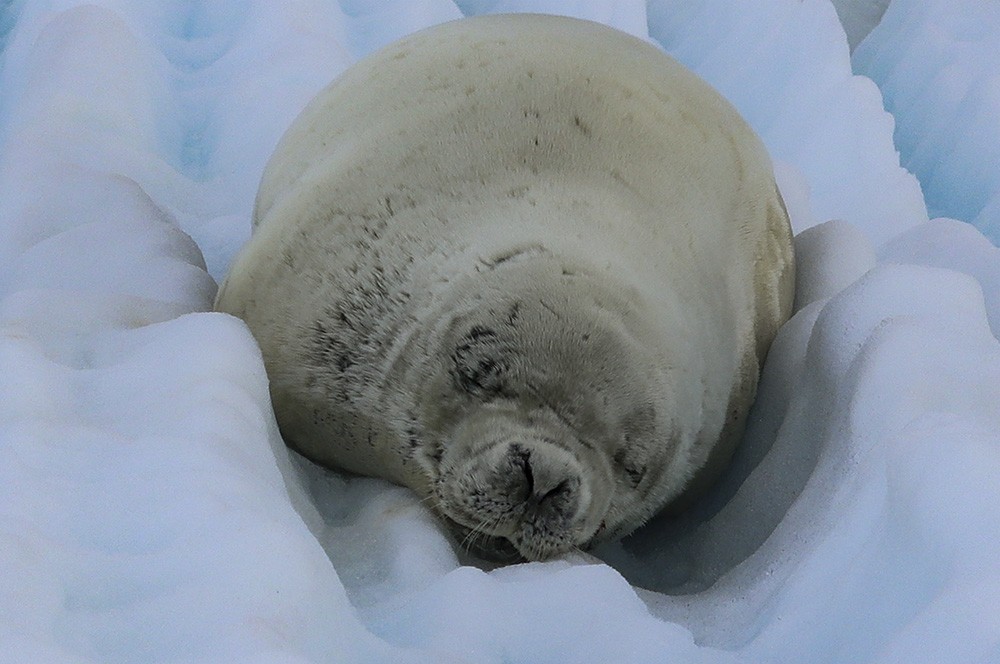
Judging from the scars, this one has definitely been in some scraps with other seals.
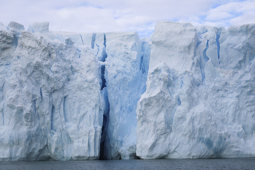
Another deeply cracked section of the glacier.
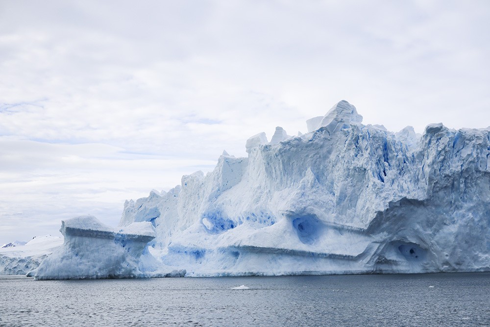
And another section, with striations and holes testifying to the effects of waves and wind.
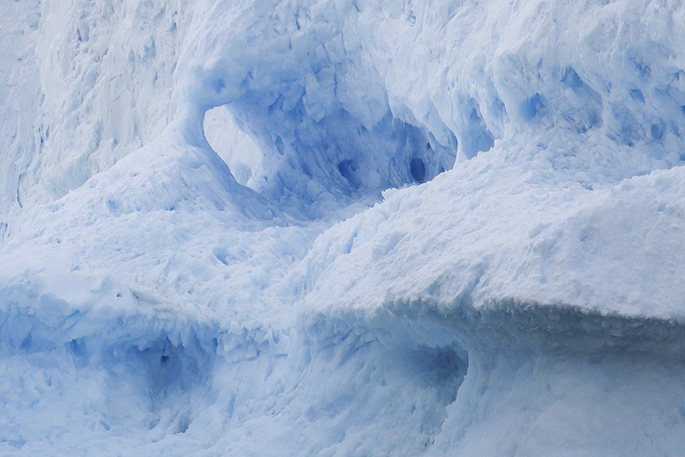
And a close up showing the disintegration of the ice and the wonderful colours within.
Deep crevasses indicating that some of these blocks will probably before too long break off and float away.
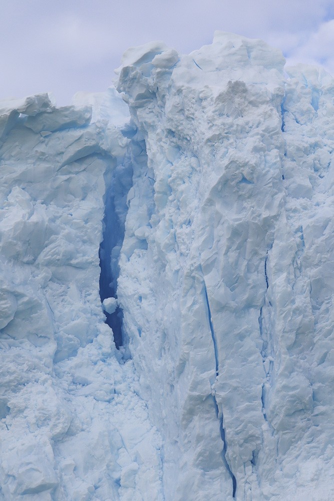
And the last photo of this magnificent glacier with a snowball trapped in a crevasse.
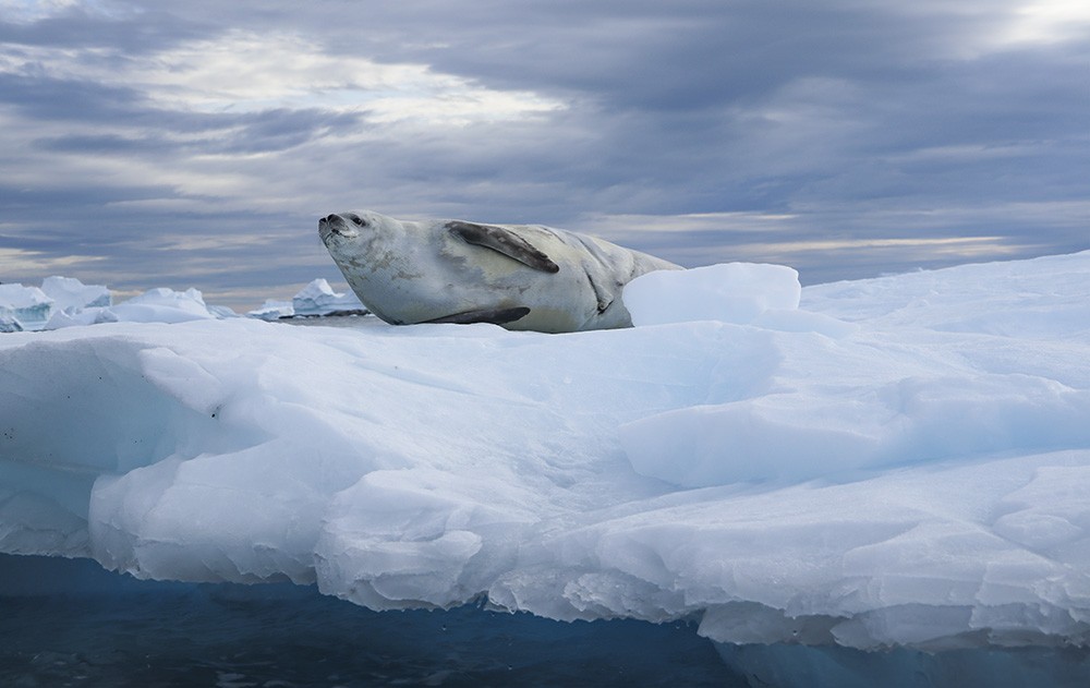
Another iceberg, another seal, this one checking us out as we circled its refuge.
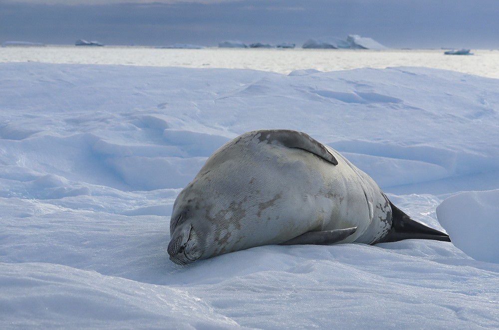
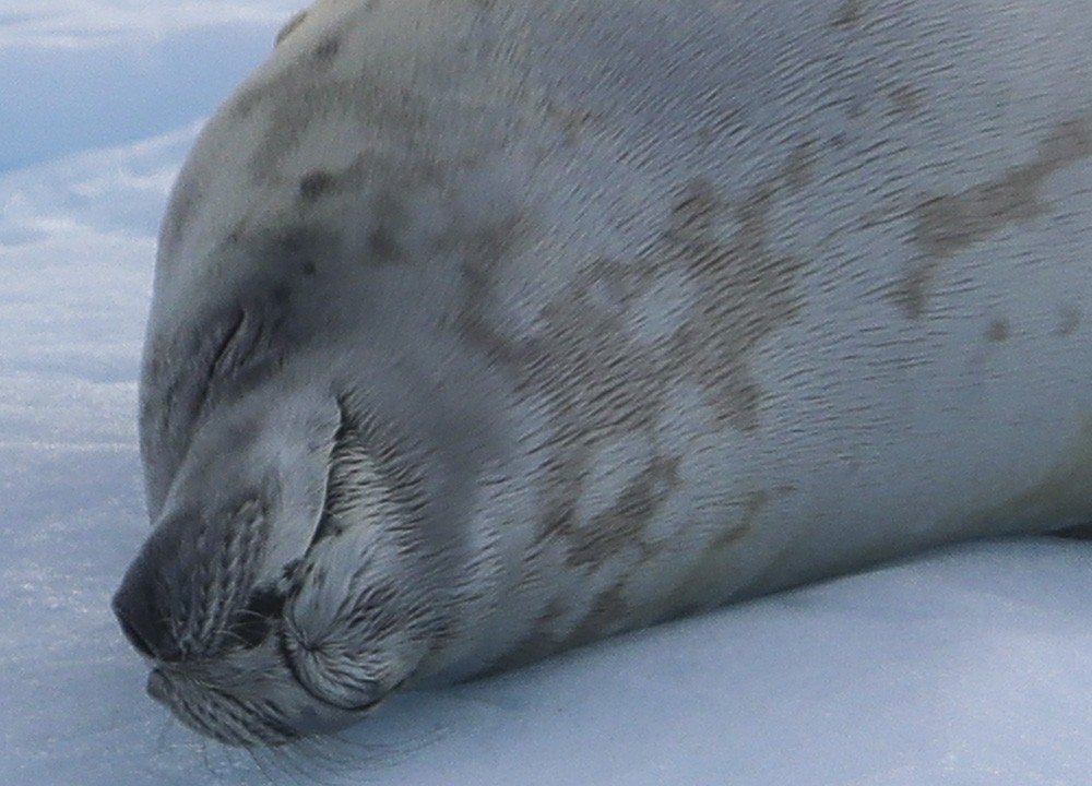
Back to sleep.
But certainly no sleep for us as back on the ship, we were treated to a hearty barbeque out on the deck. Certainly, the chilliest weather in which I have been dining outside, but what a treat and fabulous views all around.
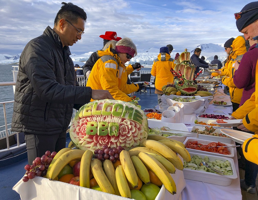
A full spread of salads and BBQed meats and some fairly impressive fruit carvings as well.
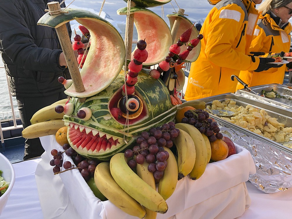
An impressive sea monster, with sails – an interesting and fun flight of fancy.
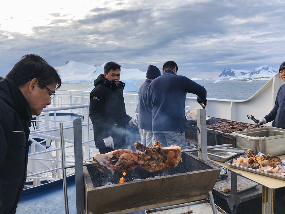
Pork, beef, sausages, on the spit or BBQ – plenty to choose from, and delicious.
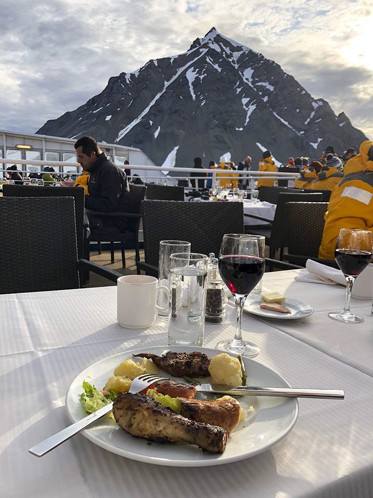
The meal with a nice glass of red, and what a view.
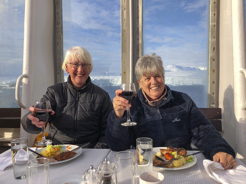
Even in the shelter of the glass panels, it required several jackets to stay warm, and my ‘hat hair’ is a little unusual!

At the end of the evening, one of the members of the British Heritage Trust who had dined with us was ferried back to Stonington Island to continue his survey work, so that the BAS huts will be restored to their original state next summer.
Reluctant to leave the outer deck, I stayed until most had gone indoors, and warmed my hands on the dying embers of the spit.
Another fantastic couple of days which I hope you have enjoyed, skimmed through at least. More still to come and in the next blog – a morning paddling excursion to Horseshoe Island, an incredible tilting iceberg at Laubeuf Fjord and yes, the polar plunge!
If you have enjoyed my photos and story thus far, I would love it if you would leave a comment, or ask a question or just say ‘hi’.
‘CHEERS’ to you all,
As always a fascinating blog and stunning photography. Thank you for sharing, Joanna!
Great to read your blogs and visit Antarctica in the warmth and comfort of my own home. Thanks Joanna
Absolutely fabulous memory and very special re count of our trip. Is great for me to share with my family and friends as you write it so well and your photographs are stunning Joanna.