Dear friends,
Last week I had the opportunity to visit the Chatham Islands and spent three very full and fascinating days with a ‘Women in Photography’ group – six of us under our expert leader Lesley Whyte. Not only was she the photographic guru, never tiring of reminding us of shutter speed, aperture speed, get down low on the ground (no tourist shots please), but she also drove us confidently over the gravel roads and tussock paddocks to the best sites to capture the landscape, the coastline, the fur seals, the akeake trees, the fishing ports, rusty wrecks and much more.
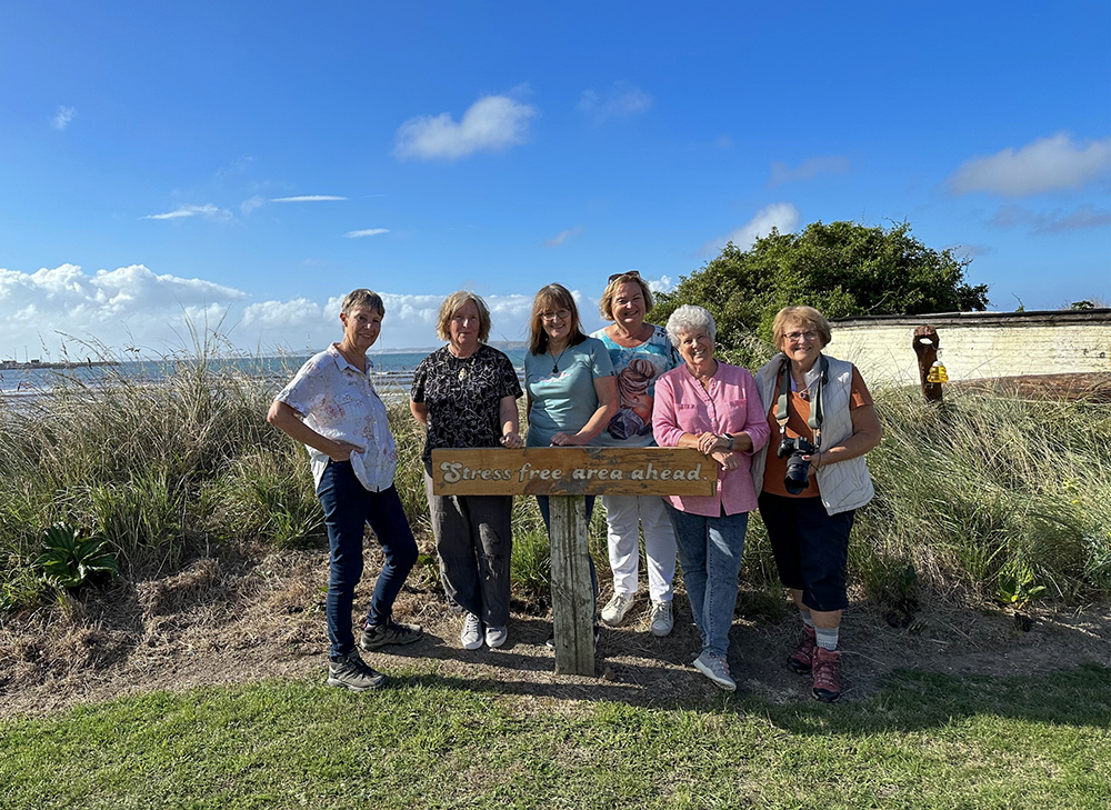
Six keen photographers – left to right: Gill, Julie, Helen, Karen, JM, Adrienne – just arrived and excited to be here
Where are the islands?
The Chatham Islands lie in the South Pacific Ocean some 800 km to the east of Christchurch and are New Zealand’s most easterly region. An archipelago of 11 islands, only Pitt and Chatham are inhabited with a total population of 800 (2022). With their time set at 45 minutes ahead of the rest of NZ, they are the first place in the world to see the dawn of a new day.
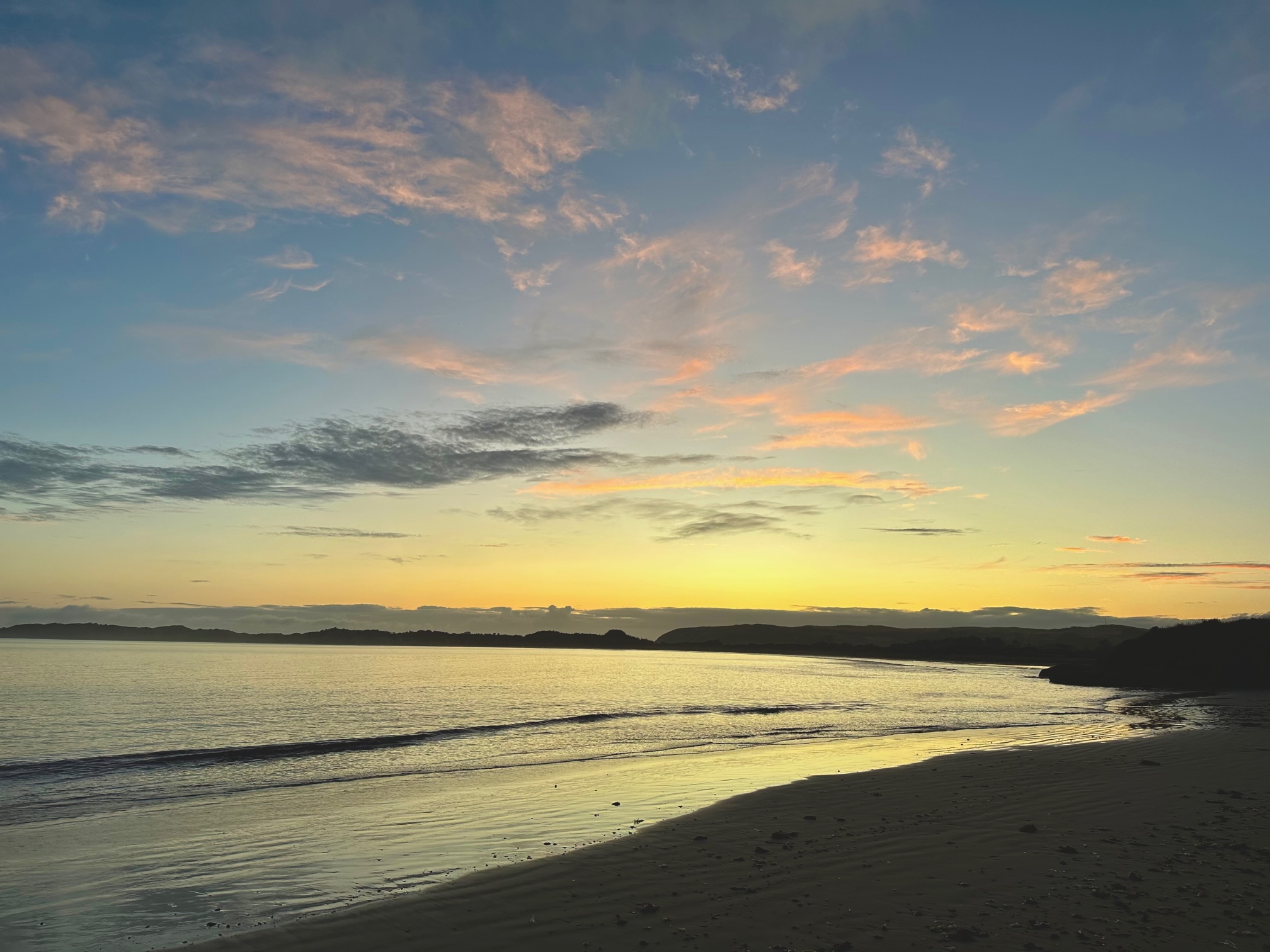
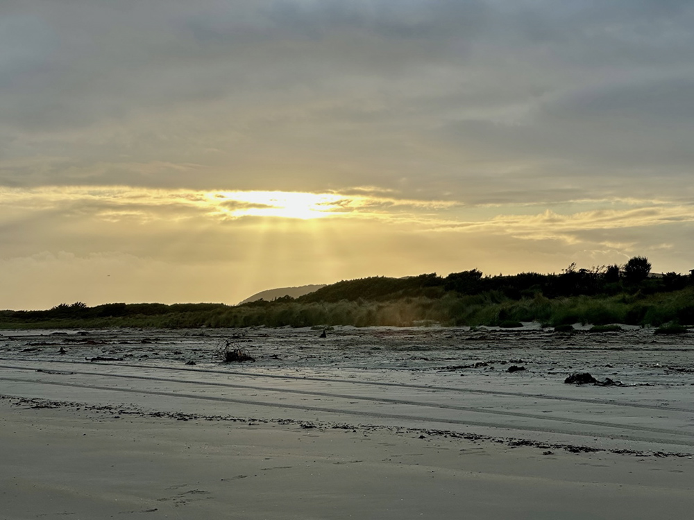
Dawn glow over the harbour at Waitangi
A map of the two main islands of the Chathams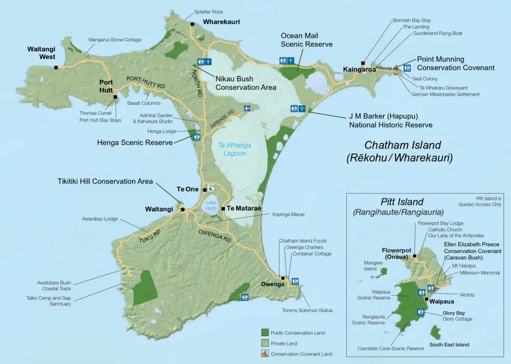
We only visited Chatham Island, but managed to cover most of the island to the north of Waitangi
A bit of history
The islands were settled over 800 years ago by the Polynesian ancestors of the Moriori people, and were the last of the major Pacific Islands to be settled. The Moriori made a conscious effort to set aside warfare and killing and to live in peace. This is known today as Nunuku’s Law named after the spiritual leader, Nunuku Whenua who laid down the covenant of peace over 600 years ago. That covenant remains unbroken by Moriori to this day – a world record for peacekeeping. They named their island Rēkohu, meaning ‘misty skies’ after the mist that sometimes clings to the land.
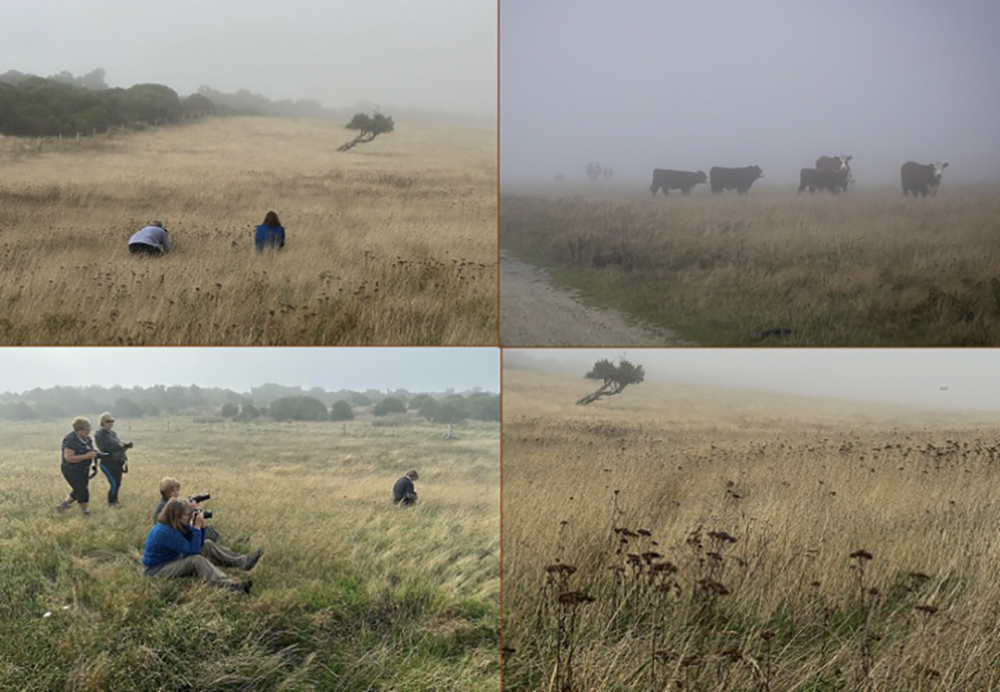
Early morning shoot to capture the akeake trees and cows in the mist
Europeans arrived in 1791 and found the islands already inhabited by the Moriori. Nevertheless, Lieutenant Broughton ‘claimed’ the islands the name of King George III, and renamed the main island ‘Chatham’ after his ship HMS Chatham. European settlement dates from the early 1800s with sealers, then whalers and farmers. Two North Island NZ iwi (tribes) the Ngati Tama and the Ngati Mutungu arrived in 1835 and made these islands their home. Today the people of these three main cultural groupings, with their unique identities and heritage live together on this remote outpost. They are the Chatham Islanders.
The lay of the land
The landscape is wild with volcanic peaks thrusting up out of rolling peatland, towering sea cliffs, basalt columns and rocky shorelines, endless kilometers of sandy beaches and the ever present ocean.
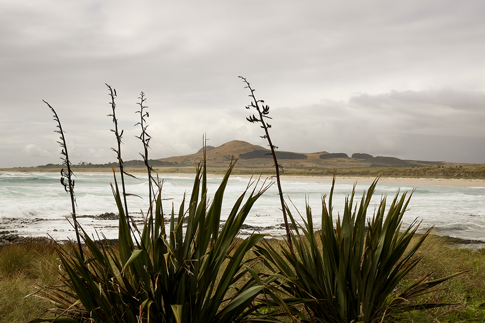
Looking through flax bushes across to a volcanic peak – Mt Chudleigh – from Splatter Rock in the far north of the island
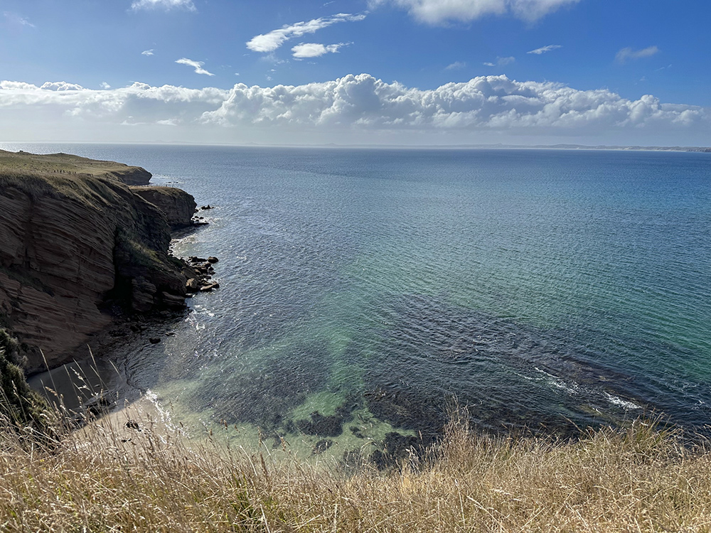
Impressive cliffs photographed from Tikitiki Hill near Waitangi
Life in the islands today
The main port and settlement is Waitangi and the local economy depends largely on conservation, tourism, farming and fishing. There are three primary schools but no secondary schools on the islands so for secondary schooling the pupils mainly go to NZ to continue their education. Much of the food, other than meat and fish is brought in from mainland NZ (sometimes referred to by the islanders as ‘West Island’) and in return the Chathams send crayfish, paua (abalone) and fish. Other commodities such as clothing, hardware, fuel and general needs are also shipped in from NZ.
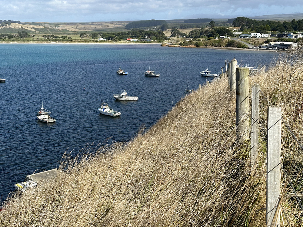
The port at Waitangi with the township in the background
Flora and Fauna
The rich diversity of plant and birdlife make the islands important to conservation nationally and internationally. The islands support 20% of NZ’s threatened bird species and 11% of its plants. Much of the original vegetation has been cleared or altered due to human activities. There are however, still many areas where the original sand dune plants can be found, some dry and wetland forests still with endemic trees such as the akeake, and increasingly new areas are being set aside and allowing regeneration of native plants. Unlike mainland NZ, most of the island, including the beaches, is privately owned land. Many attractions for visitors like ourselves, are on private land and access to them requires permission and payment of an entry fee. These fees allow the owners to maintain the sites and conserve the nature.
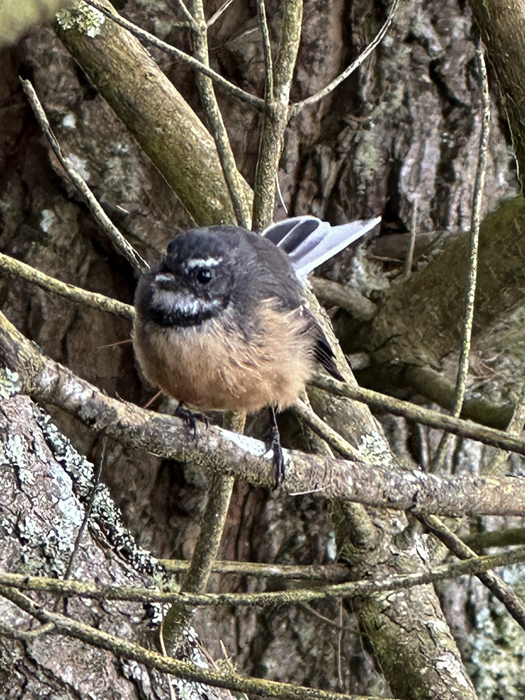
Managed to capture a photo of a fledgling fantail amongst the trees one morning
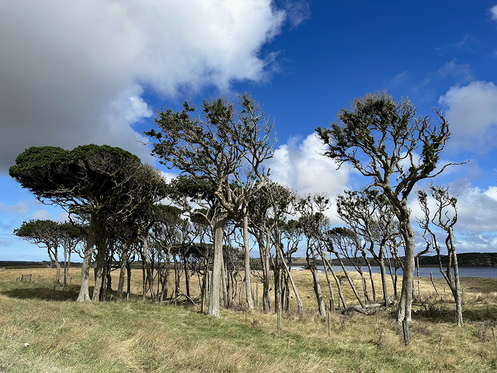
A small grove of the hardy akeake trees
The seafood
The islands are renowned for their abundant seafood, with crayfish, whitebait and paua (abalone), sea urchins and shellfish being delicacies as well as many species of fish being caught daily. During our trip we dined very well at the Waitangi Hotel and could taste some of the delicious seafood for ourselves.
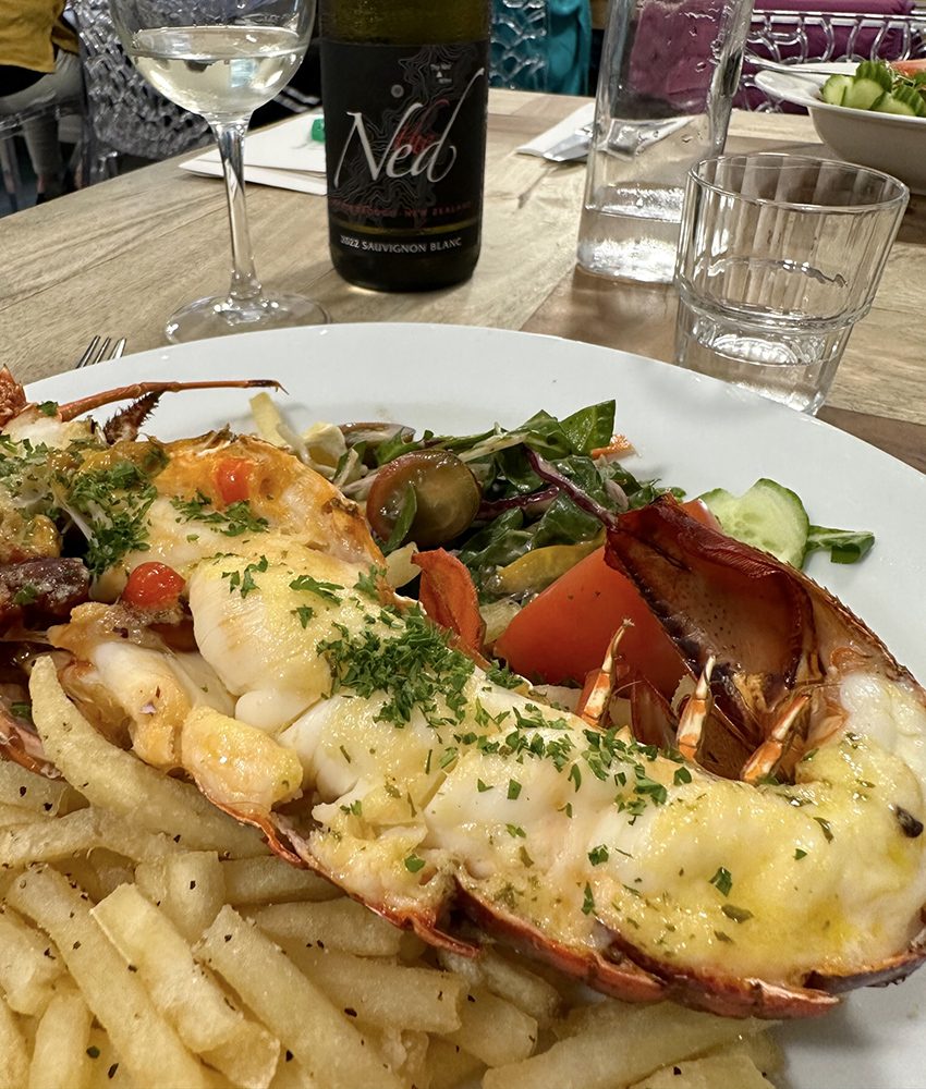
Buttered crayfish with a nice Sauvignon Blanc
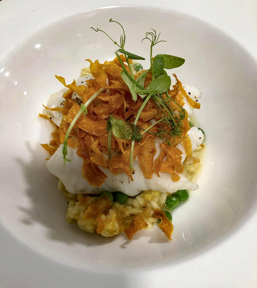
Blue cod on a bed of pumpkin and pea risotto and topped with kumari chips
The community
We were lucky enough to be in the islands for their annual Local Wild Food Festival, which not only gave us an opportunity to sample their specialities, both savory and sweet, but also allowed us to meet some of the locals, see the school kids performing and become involved in the general enjoyment of a day out with family and friends.
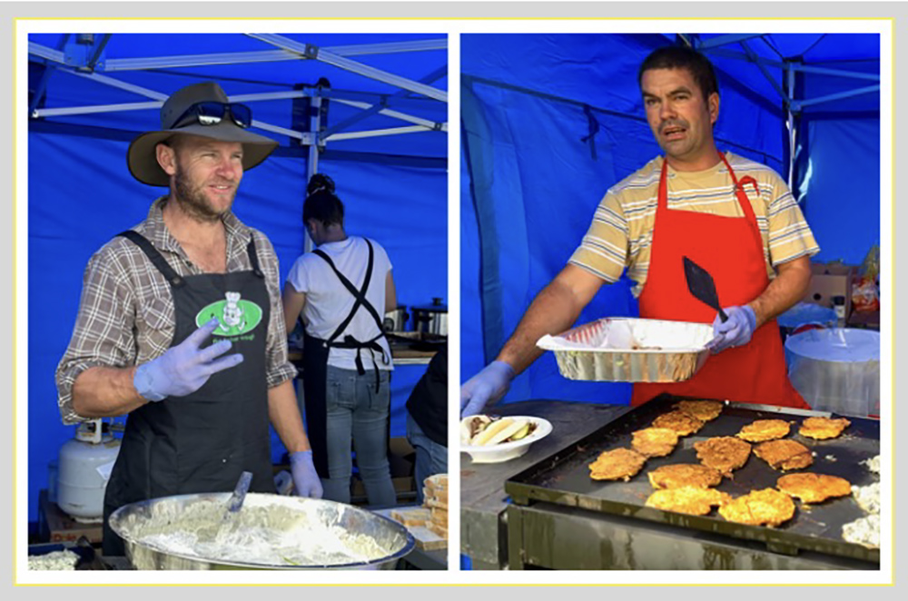
This stallholder indicating, ‘Yes, you get three in a serving’. Paua (abalone) and pipi (shellfish) fritters on the go
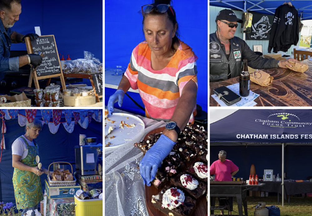
Plenty more stalls with delicious offerings and bikers running a competition at their booth
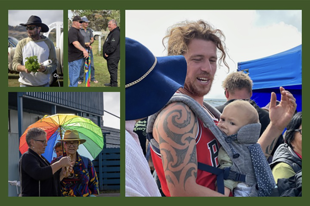
Looking after the baby and chatting with friends was an enjoyable part of the day
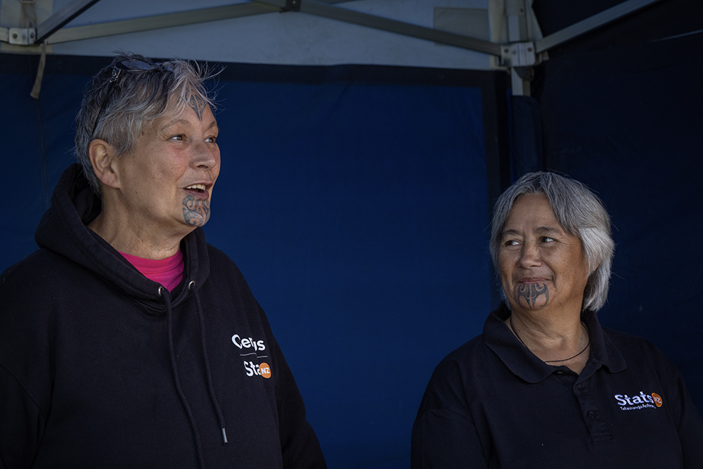
Two senior women with beautiful, traditional ‘moko’ were there to assist any of their fellow islanders
to complete their national census forms, the census due that week.
Music for relaxation and to accompany the school pupils in their action songs.
Later the parents were encouraged to join in and did so with great gusto and to the enjoyment of all.
Plenty of fun for the kids – climbing and jumping, coke and popcorn, and that very important event, the ‘lolly scramble’
The landscape
Before we left for the Chatham Islands, we were advised that the weather could be very changeable and extremely windy, so we should be prepared and bring thermals, rain gear, fingerless mittens and a beanie, ready to travel the island and do our photography. However, were we lucky or what? We were gifted a lovely spell of weather with just a few drops of rain the last day and otherwise we had sunny days, a light breeze and enough clouds to make our photos interesting. Lesley had planned a great itinerary which had us driving all over the island to get the best vantage points for the landscape and the various geological and geographical features as well as a number of glimpses into the history of the islands. Most of the rest of this blog, and the next, will therefore be of the stunning landscape with a few plants, flowers, birds, seals, sheep some of the local characters thrown for good measure.
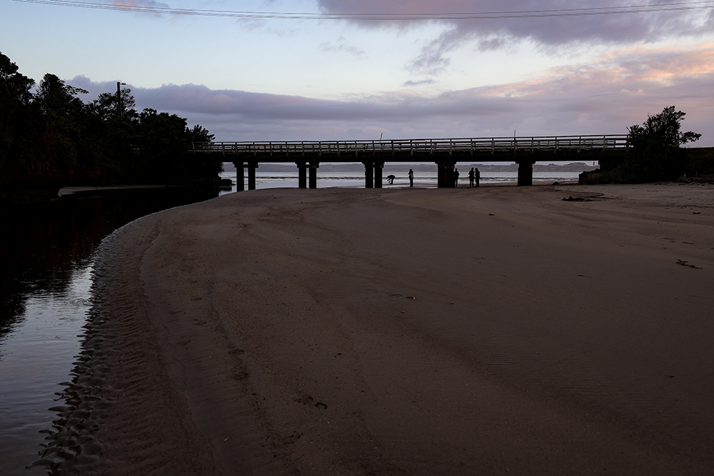
First challenge – the bridge
As an ‘exercise’ for the photographers, we rose early the first morning to capture the sunrise and all angles of the bridge over the Mangatukarewa River and the beach at the port of Waitangi. This was particularly useful for me as I have a new mirrorless camera (Canon of course, I have been using this brand since my first SLR bought in Japan in 1977) and it was surely a challenge to work in the ‘manual’ setting rather than lazily using ‘automatic’, as has been my won’t.
First rays of the sun on the beach near Waitangi

A lonely seagull mirrored in the wet sand at the water’s edge
My fellow photographers trying out the angles under the bridge, while I ventured further up the river
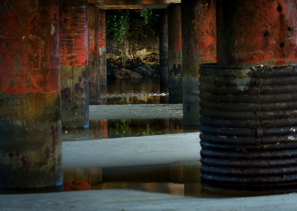
And for sure the colours and patterns of the pillars and water under the bridge were indeed photo worthy
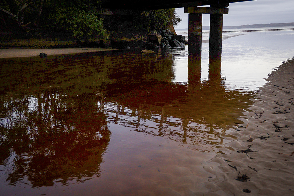
As were the reflections of the bridge and trees in the pool of water beneath
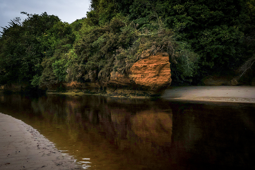
Further up the peat-stained river, the rocky outcrops painted a lovely reflection in the water
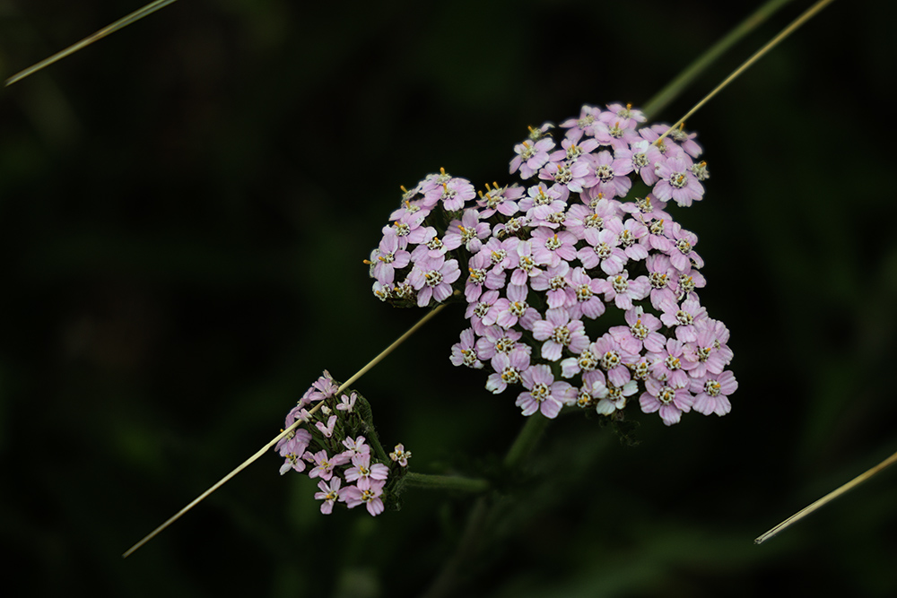
Walking away from the river, I spied this lovely little clump of pink blooms with grasses aligned behind
Basalt Rock formations
The Chatham Islands – the only part of the Chatham Rise above sea level – form part of the now largely submerged continent of Zelandia. The islands’ geology consists of a Mesozoicschist base (Wikipedia), typically covered by marine sedimentary rocks. Both these sequences are intruded by a series of basalt eruptions. Volcanic activity has occurred multiple times since prehistoric times but currently there is no active volcanism near any part of the Chatham Rise. The basalt rock formations are particularly interesting in the north of the island. We enjoyed wandering and photographing at the Splatter rocks at the western end of Wharekauri Beach.
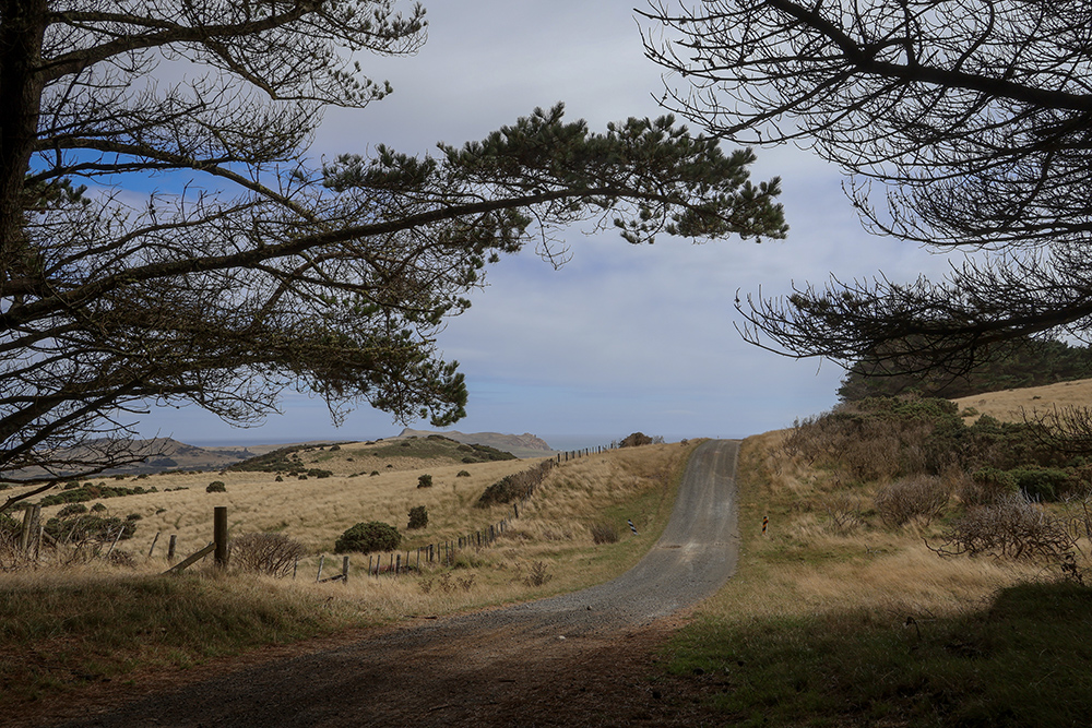
Typical scenery and gravel road on the way to the Splatter Rocks
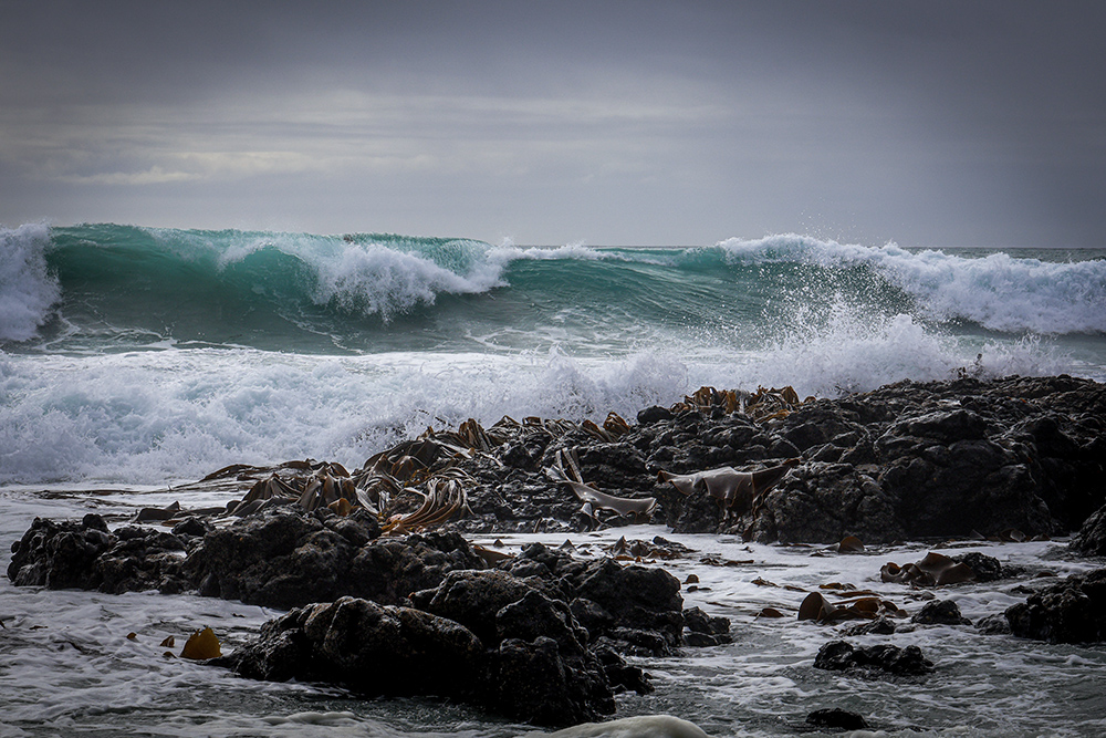
Impressive clusters of rocks and kelp with glorious, dancing waves crashing against them
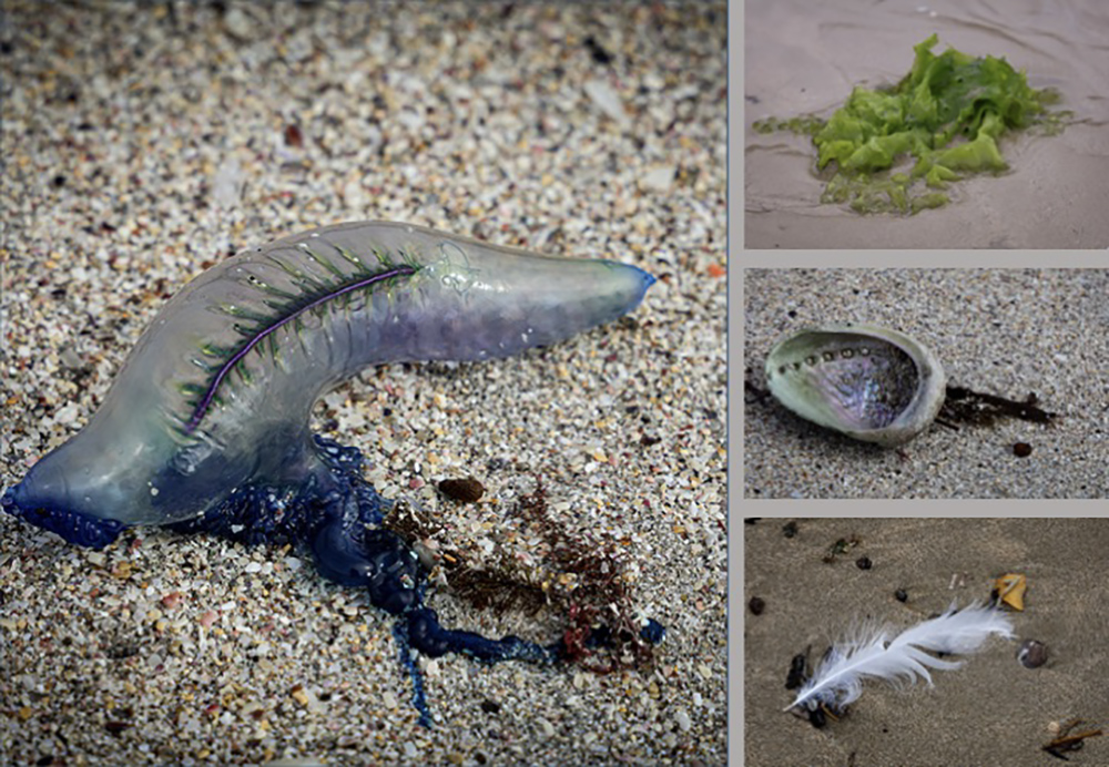
Plenty of details to capture on the beach – a bluebottle jellyfish, sea lettuce, a paua shell and a feather
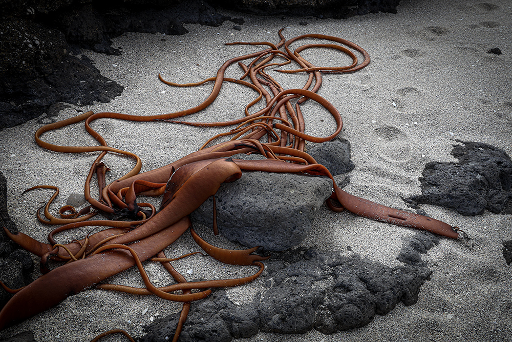
The curling tentacles of kelp draped artfully on the rocks and sand
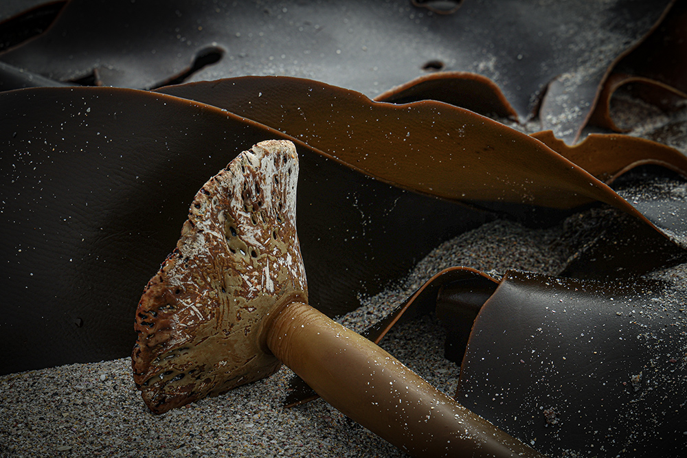
The detached foot of a giant kelp by which it has been anchored to the rocks
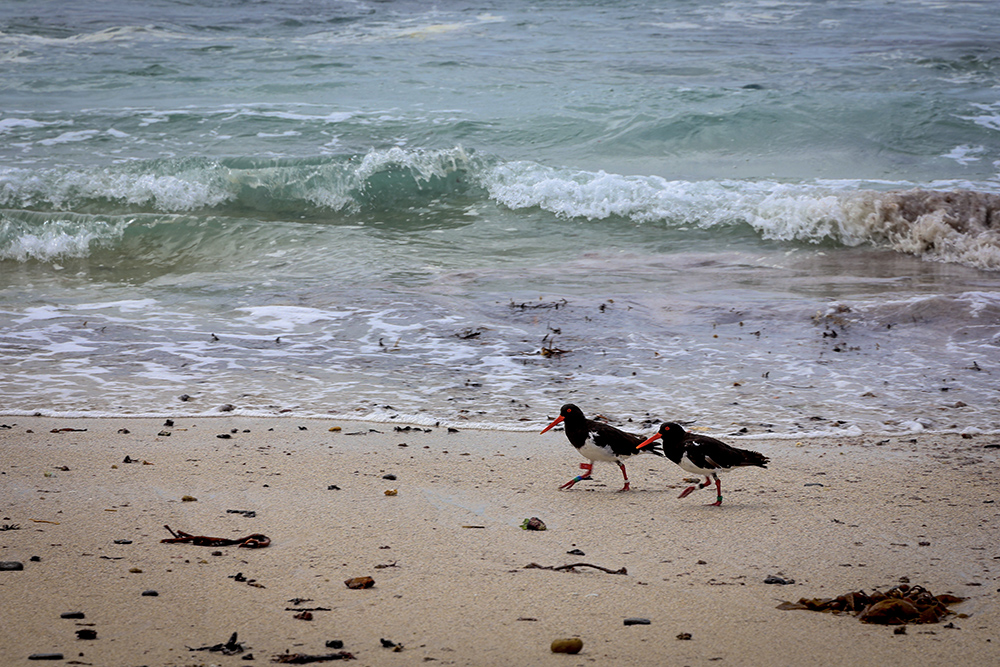
A pair of Oyster Catchers in step long the beach
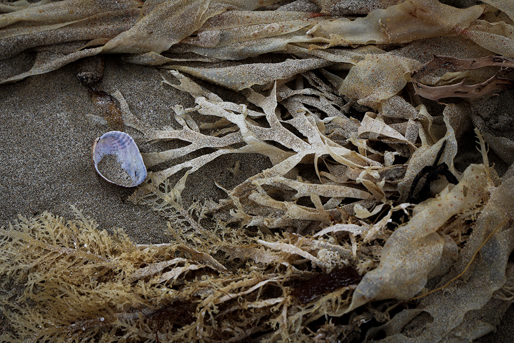
A melange of kelp of all varieties and a sand filled paua shell showing of its pearly colours
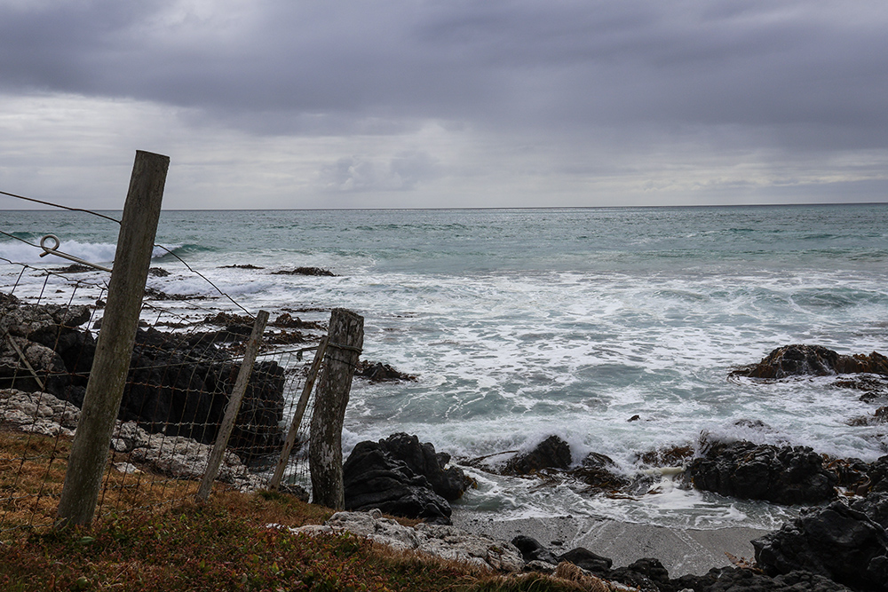
The end of the line – fence posts right down to the shore, the sea foaming as it hits the rocks
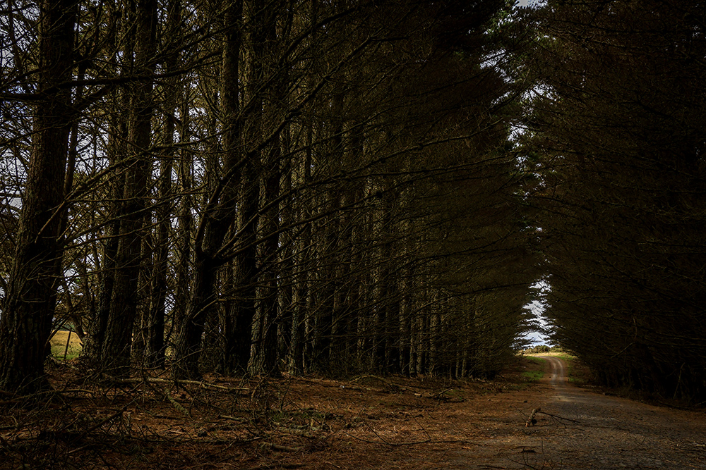
On the way back, we stopped to take photos and I walked through this grand avenue,
almost a tunnel, to reach the sunshine at the other end.
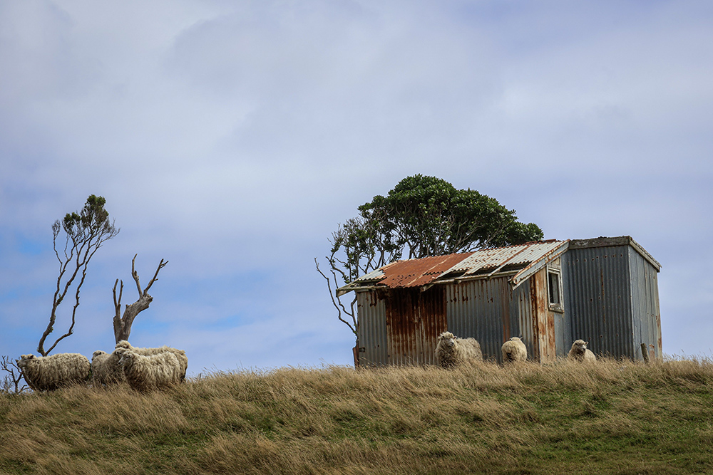
Another stop for photos as we saw this cluster of sheep seeking some shade by an old corrugated iron shed
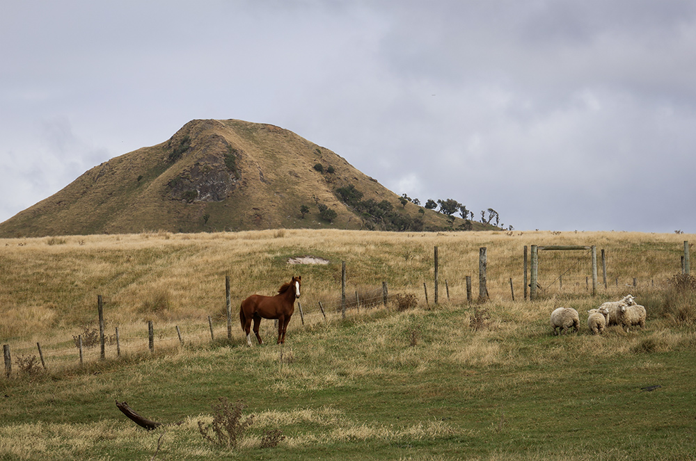
Looking in the other direction, another group of sheep and a horse enjoying the lush grasses, a volcanic peak behind
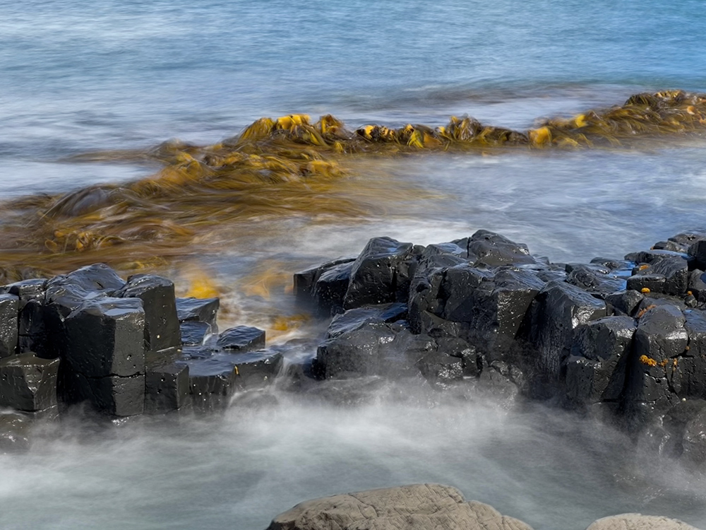
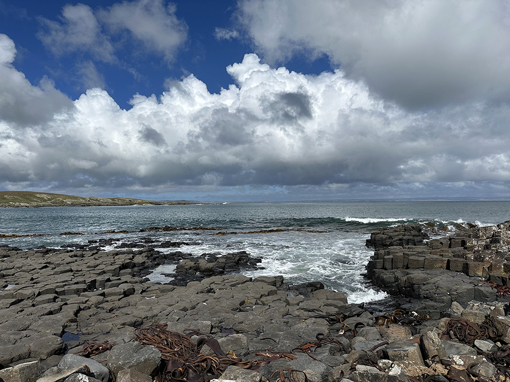
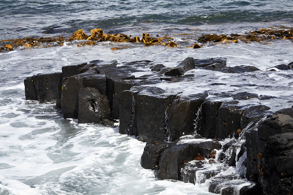
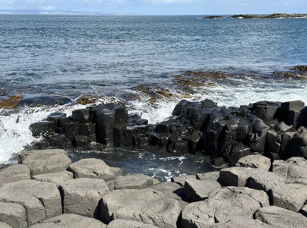
The Basalt Columns
We spent quite some time at the impressive Basalt Columns at Ohira Bay. Looking like stepping stones or the ruins of an ancient city, the play of colours on the rocks, wet or dry, the golden hues of the swaying kelp and the surging of the waves, was mesmerizing.
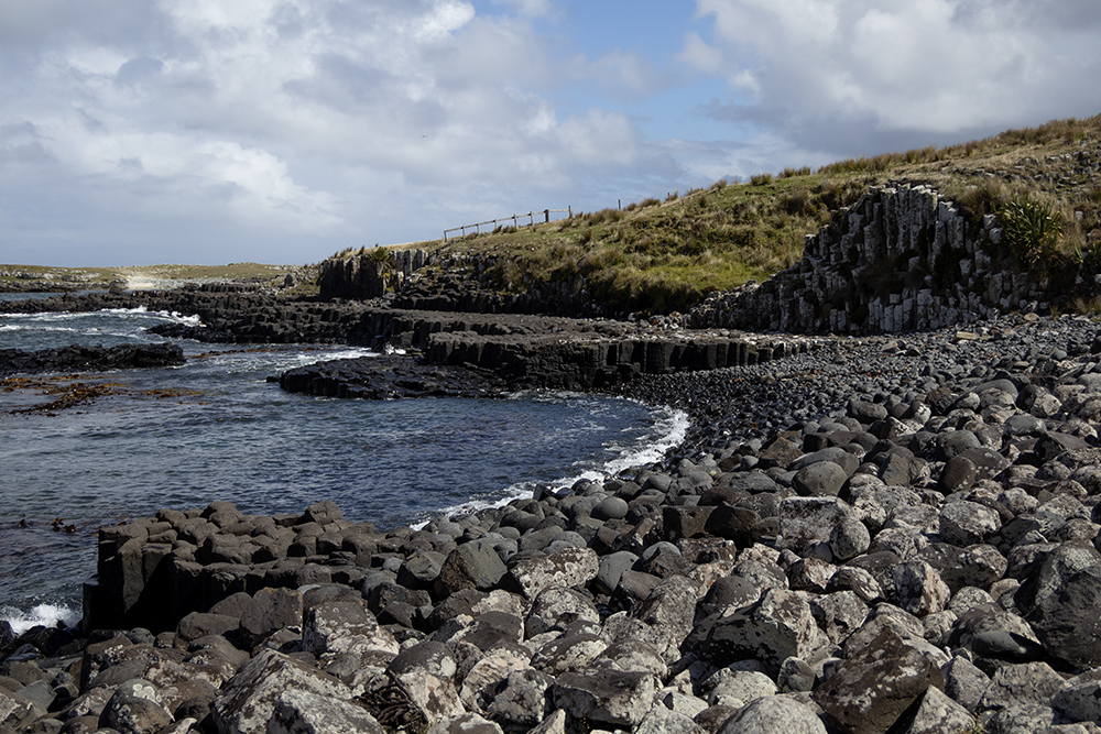
Looking west along the beach, you can see that the columns are exposed at the water’s edge but reach back into the land
Looking east along the bay, the hexagonal columns have been eroded to different levels
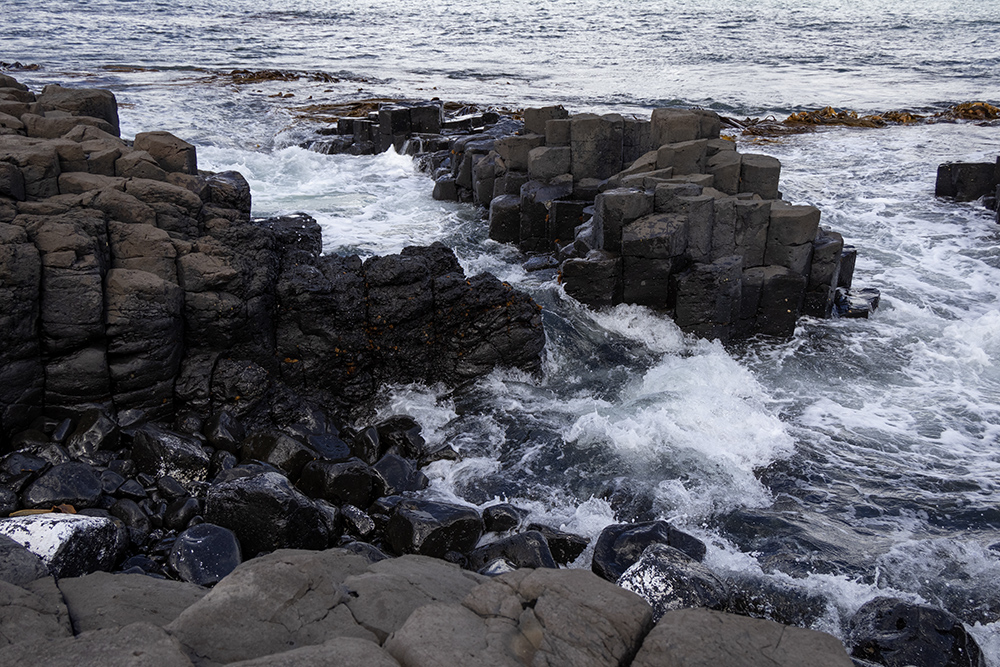
The waves surging through any crevice they can find
And cascading over the rocks, then draining in rivulets before being awash again
The wet rocks shining black in contrast to the drier grey slabs
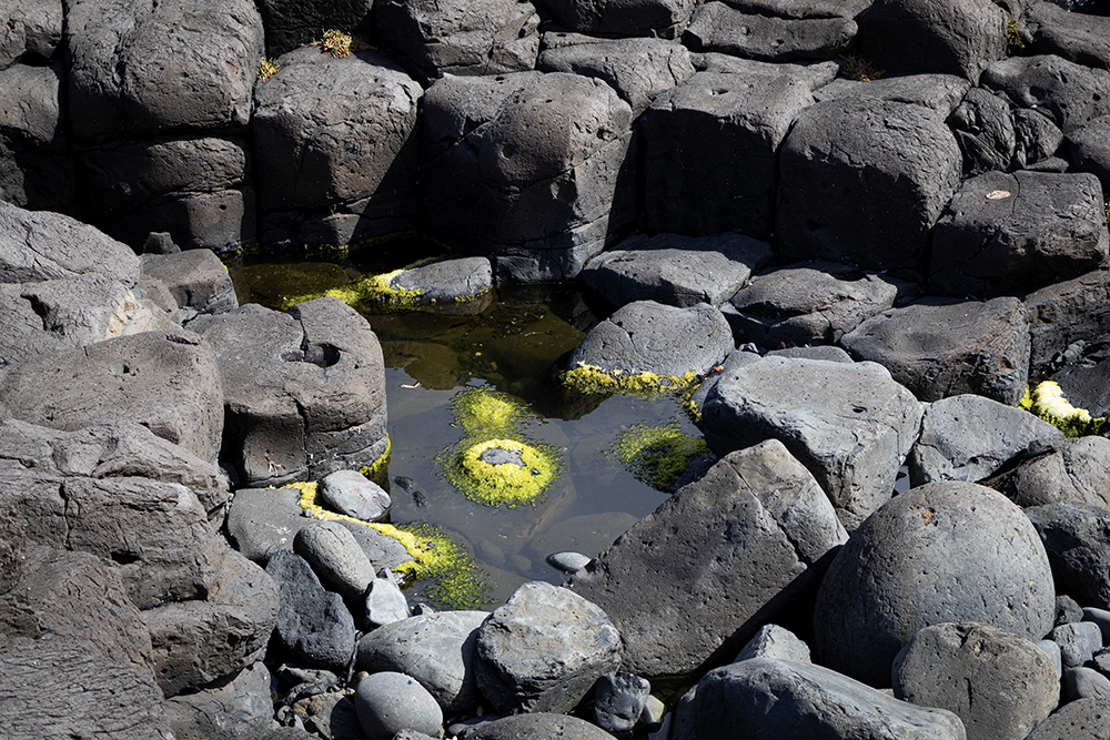
Almost luminous lichen blooming in the rock pools, a testament to the purity of the air
I hope you have enjoyed this rambling tale, and there is still so much more to show and tell from our few days in the Chatham Islands, but that’ll do for this journal entry. There’s more to come in Out and About in the Chatham Islands #2 – shipwrecks and seals, flowers and fungi, wekas and whale pots ….
With all good wishes to you, my friends and followers. Please feel free to leave comments and questions in the section below.
Until very soon,
Morning Joanna,
Over my cuppa I have relived this part of our trip, through your eyes! Thanks for all the in-depth history’s detail too..
Marvellous, looking forward eagerly to your next instalment!
So nice meeting you and our other like minded photographers through W I P
What a fascinating history and the colours under that bridge… wow… and those basalt columns – loved it all!
You have written a great story of our time on Chatham Island. Just reading and looking at your awesome photos I feel I am back there again. Oh, for another meal of crayfish! Thank you, Joanna.
Stunning – thank you for sharing !!